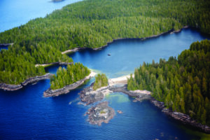
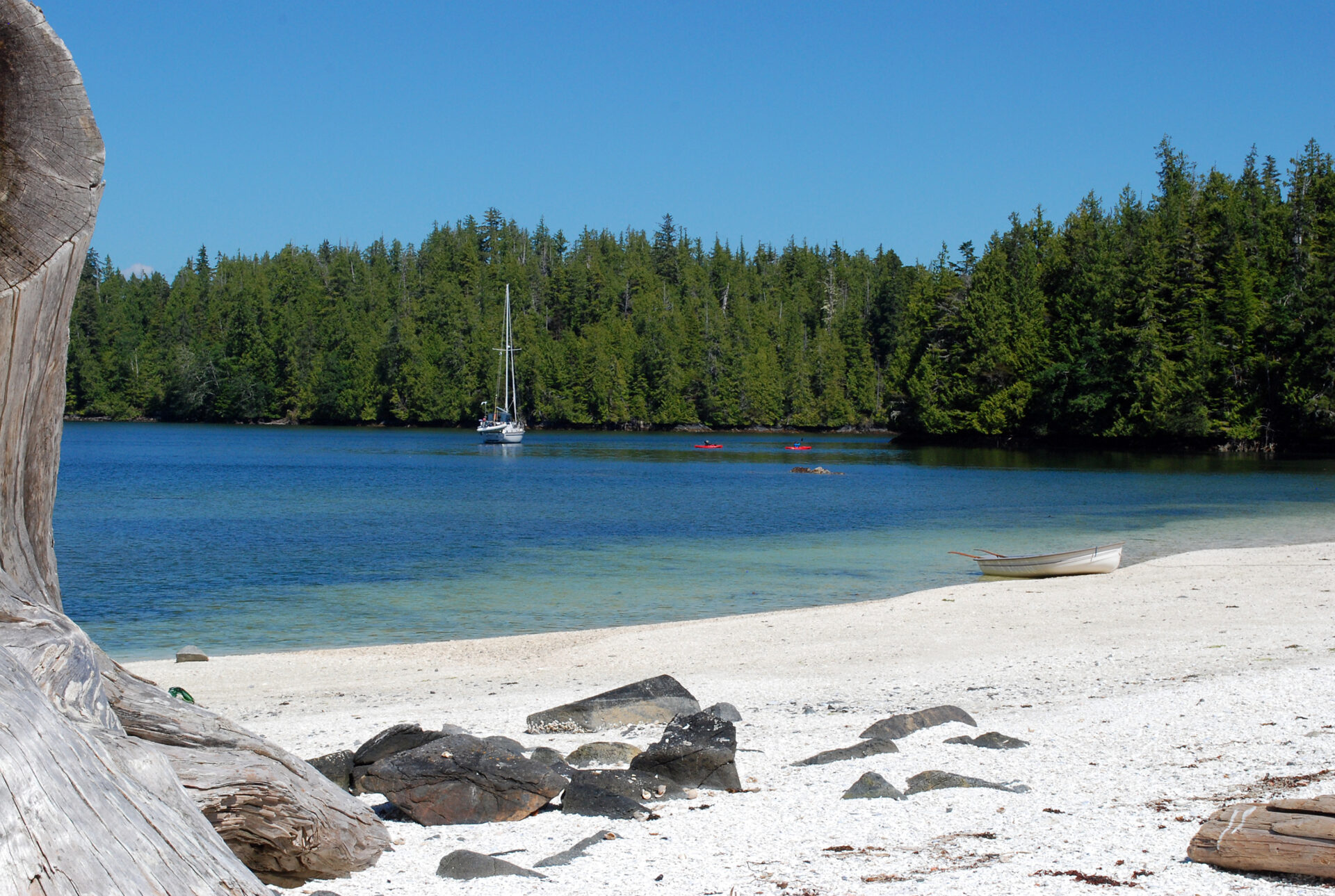
The image of wind and water meeting on a distant beach is a vision that calms the hearts of boaters the world over. The anchorage can be anywhere, but often the more remote the destination the greater the feeling of escape. For us, such an anchorage lies in the lee of Fury Island and is one of most beautiful on the B.C. coast. Backed by the forested shores of Penrose Island, this unique spot offers ocean vistas framed by dazzling white beaches. In foul weather the cove provides shelter from the wind-whipped seas of Queen Charlotte Sound. In fair weather, it becomes an anchorage so sublime it’s hard to leave. At high water, when the sun is shining, the strips of crushed white shell turn the water aquamarine as it shimmers onto shore.
Getting There
If not for its remote location, Fury Cove—as it’s popularly known—would be a very busy place in summer. Boaters who venture north know Fury Cove as one of the great incentives for testing Cape Caution. There’s no avoiding the open waters of Queen Charlotte Sound when rounding this cape and passing the entrance of Smith Sound to get to Fury Island at the mouth of Rivers Inlet, and boaters should pick their weather carefully.
When Captain Vancouver was surveying these waters in the summer of 1792, he noted that this stretch of coast was exposed “to the violence of the sea, which, from an uninterrupted ocean, broke with great fury on the southern shores.”
Fury Cove is part of Penrose Island Marine Park, its numerous islands, islets and reefs acting as a natural breakwater but also demanding careful pilotage when approaching the anchorage. Rouse Point marks the southwest extremity of the islets and reefs that lie off Fury Island and we use this as a reference for making a turn toward the main entrance, which lies between Heathcote and Cleve Islands. Fury Point marks the south end of Cleve Island, which is identifiable by its steep rock cliffs. We favour this shore as we enter Exposed Anchorage, a deep basin fronting the entrance into Fury Cove.

Exploring the Area
When we entered Fury Cove last summer, it had been a long time since our last visit. We wondered if the shell beaches would be as beautiful as we remembered them. They were. A few boats were anchored in the cove, and one was in our favourite spot on the west side of the anchorage where the lovely beaches lie. However, there was room to anchor north of this boat where it was a short row to the beach-fringed islet next to Fury Island. But first we had to find our dog.
Amy, a wire fox terrier, panics at the sight of sails being raised, and the rolling motion of our boat as we rode the uncomfortable swells in Queen Charlotte Sound had frightened her even more than usual. So when our 14-year-old son, John, popped his head out of the companionway to announce that he couldn’t find Amy, we knew she must have found a new hiding place. We checked the usual spots but found no furry stowaway. So we called to her and were surprised to hear the sound of her dog tags jingling from underneath the propane oven. Somehow she had managed to squeeze herself into this sliver of space and remained wedged there for the entire crossing.
For a second it looked like Amy might be stuck but she was able to squirm out on her belly when she realized a dinghy ride was in the offing. We had brought two dinghies on this trip—an inflatable with an outboard motor, and a hard dinghy for John to row or rig with a sail at the anchorages. (His older brother, Reid, was more interested in playing his guitar.) The two dinghies rode, one on top of the other, on the foredeck of our 48-foot sailboat while underway.
At Fury Cove we promptly put both dinghies in the water and took Amy ashore. Then Bill and John headed to Rouse Reef, just outside the cove, to do a bit of salmon fishing. Nothing bit but they did spot a humpback whale feeding in Fitz Hugh Sound. These marine mammals were hunted nearly to extinction before the species was protected in 1966. Since then they have rebounded and in recent years have been returning to B.C. waters each summer in steadily increasing numbers.
Abundant Wildlife
Fitz Hugh Sound is a prime area for viewing humpbacks, their presence marked by plumes of mist as they surface to breathe. When feeding, a humpback blows columns of bubbles that create a ring around a school of herring or other small fish, which it then lunges at with its mouth wide open. The baleen plates on the sides of its mouth create a pouch large enough to hold six adult humans, so it’s a pretty big mouthful. Humpbacks are large—about 45 feet long and weighing up to 40 tons—and can consume up to 3,000 pounds of seafood per day. Sea birds, attracted by the water disturbance, feed on the shrimplike krill and herring swimming to the surface.
Eagles are a common sight around Fury Island, and we’ve seen oystercatchers and other shorebirds when exploring the shoreline by dinghy or kayak. What we didn’t expect to see on our last visit, as we approached the outer beach at the southwestern tip of Fury Island, was a small flock of Canada geese. We had no qualms about shooing them away, their loud squawking out of tune with the chittering of eagles and mewing of seagulls.
Penrose History
Penrose Island Marine Provincial Park was designated in 1982 and lies within the traditional territory of Oweekeno/Wuikinuxv Nation, whose winter villages once stretched along the shores of Rivers Inlet. Today there is just one village situated on the banks of the Wannock River, which flows from Owikeno Lake into the head of Rivers Inlet. The Wuikinuxv villagers still use this park for traditional shellfish gathering, and boaters are required to use their holding tanks while anchored here.
Signs of prehistoric presence at Fury Island include the stone remains of a fish trap in the shallow channel leading from the west side of Fury Cove into Darby Channel. More obvious are the beaches of fine sand and crushed clamshells, which are middens dating back thousands of years and not to be disturbed. You can, however, picnic on them and build a small beach fire using driftwood.
A Beachside Barbecue
On our most recent visit to this anchorage we enjoyed a dinnertime barbecue on Fury Island’s outer beach overlooking the sparkling blue waters of Fitz Hugh Sound. We took ashore our propane barbecue and invited our friends Mike and Jane on another boat to join us, which they did, arriving in their red kayaks. While Reid and John tried out the kayaks, the adults enjoyed happy hour, lounging on the beached logs while tending to the barbecue. The after dinner mood couldn’t have been more mellow as our boys roasted marshmallows and the rising tide slowly swallowed the reef protecting our little lagoon.
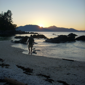
As seawater lapped across our steadily shrinking beach, the sun began to set over Fitz Hugh Sound. For a few glorious minutes the water was a golden pond and our little patch of earth was ablaze with the sun’s intense light. Then it was time to thoroughly douse the campfire, climb into the dinghy and return to the anchorage, which seemed like a populated place compared to our secluded picnicking spot. The night was calm as we headed to bed beneath a star-filled sky.
If You Go
Fury Cove’s mud-and-shell bottom provides good holding, but the anchorage is exposed to strong southwest winds. One September we dragged anchor here during a southerly gale with 40-knot gusts, but this was due to our CQR anchor being fouled on an abandoned crab pot. If gale-force southerly winds are forecast, consider anchoring in the south part of the cove with a stern line pulling your boat close to Fury Island and your bow pointed toward the centre of the anchorage.
There are other anchorages within the meandering boundary of Penrose Island Marine Park. These include Secure Anchorage, with a couple of good anchoring spots in the north and northeast sections of the cove. Anchorage is in about 60 to 70 feet and safe entrance is between Bird Island and Ironside Island. Frigate Bay has a deep anchorage on its east side, however it is more open to northwest winds. Both Secure Anchorages and Frigate Bay would be suitable for large vessels over 75 feet. The east side of Penrose Island has two large and well-protected bays—Frypan Bay and Big Frypan Bay—both of which are deep but with small nooks providing shelter.
Rivers Inlet is famous for its salmon fishing. The first cannery opened here in 1882, followed by more than a dozen others. By 1950 they had all shut down, but sportfishing still operates, with several of the old canneries converted into sportfishing lodges. The inlet’s supply centre is Dawson’s Landing—a floating community tucked among tall cedars in Darby Channel.
Facilities here for visiting boaters include moorage, fuel, a post office and a general store selling groceries and liquor. Another marina is located at Duncanby Landing in Goose Bay, on the south shore of the entrance to Rivers Inlet. Facilities here include moorage, power, fuel and showers.

