
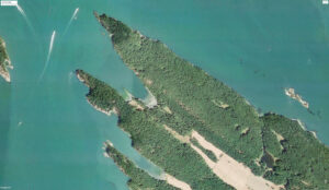
One of the great pleasures of boating happens at the end of the day, sitting on the deck with a cold beverage in hand, discussing the day’s adventures and the area’s history while witnessing a beautiful sunset. That was just the situation as Easy Goin’ sat anchored in James Bay, Prevost Island after having enjoyed a day exploring this section of the Gulf Islands National Park Reserve.

The approach into the bay is straightforward, except for a rocky reef that runs northwest off the southern shore. Although it is exposed to the northwest winds travelling down Trincomali Channel, the anchorage is bomb-proof in southerlies. Noting the head of the bay shallows rapidly, the anchor was set in 35 feet of water over a good holding sea floor.
As with most of the islands of the Salish Sea, Prevost Island had been named many thousands of years before the arrival of European explorers, by First Nations people who hunted seals there, honouring the animals who provided clothing and food by calling the hunting grounds Xwes’hwum, meaning place having hair seals.
The island was then named for Admiral James Charles Prevost, commander of HMS Satellite and the British commissioner for the San Juan Island boundary dispute (The Pig War) of 1859 to 1872 between the British and the United States.
Most of the island was bought as a farm in the 1920s by Digby de Burgh, an Irish nobleman from County Limerick, who used it to raise sheep, goats and cattle. His descendants still own much of the island, which is still primarily a sheep farm. A few smaller private homes have been built on the northwest side of the island.
In 1996 the Pacific Marine Heritage Legacy acquired portions of waterfront in James Bay and Selby Cove and adjoining lands connecting the two. The land later became part of the Gulf Islands National Park Reserve. The land on Selby Point remains privately owned.
James Bay is almost completely encompassed by park land, from its northeast entrance to its head and halfway along its southwest shoreline.
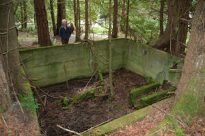
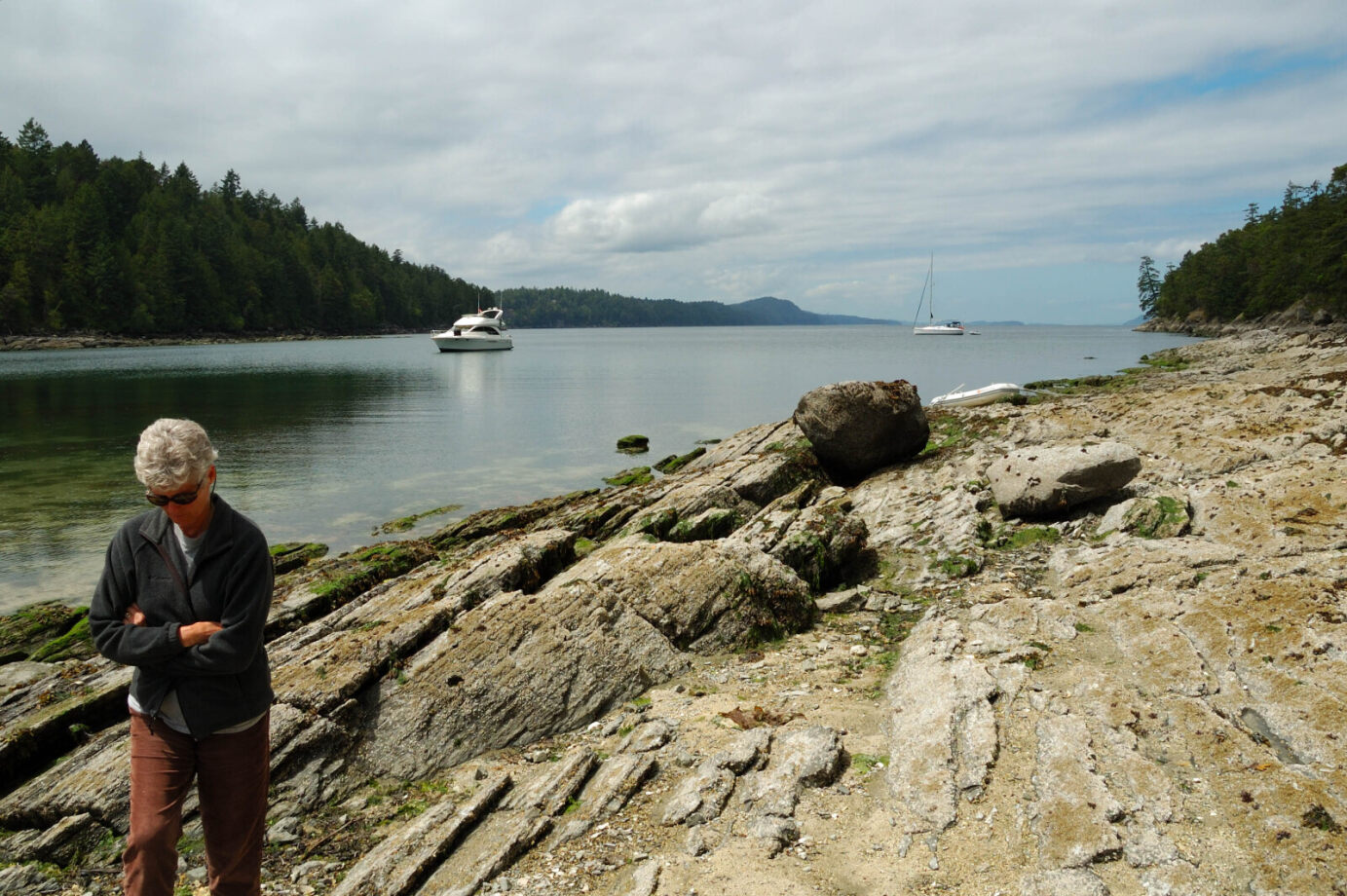
We launched the dinghy and went ashore on the broad, gravel beach at the head of the bay known as O’Reilly Beach. Here we discovered a park sign that shares some of the area’s history and park rules. Just inside the tree line we discovered the foundation of a small building and cedar fencing being reclaimed by mother nature. There was also a tree growing up through the centre of a tire, which made for interesting conversation.
From the park sign there are several trails that lead across the park land. Some are sheep and goat trails, and others are maintained by the park’s organization. We selected the trail that follows the north side of the bay and leads to Peile Point. We found the 30-minute hike to be a bit strenuous, maybe our age is finally catching up with us, but nevertheless it was a good workout, gaining 65 feet (20 metres) in elevation then descending to sea level only to rise again before arriving at the point. Our efforts were rewarded with views of Trincomali Channel, Captain Passage, and the surrounding islands.
On the west side of the bay there is a rock and sand reef that runs to the north out into the bay. At low tide, the resident sea life is exposed. We enjoyed spending most of the afternoon exploring and checking out the sea life residing on the rocks and in the many tidal pools.
Upland from the reef are some campsites and an apple and plum orchard planted by Digby de Burgh. The orchard is popular with photographers in the spring with its fruit blossoms and for foraging in the fall.
A dinghy exploration had us following the shoreline west to Selby Cove. Named in honour of Lieutenant William Derenzy Donaldson-Selby who served aboard HMS Ganges between 1857 and 1860. Along the way we were fascinated with the many colourful sea stars and crabs. Selby Cove is a good alternative anchorage to the more popular James Bay. It offers good holding in 25 to 30 feet of water over a mud bottom. The cove is also open to the northwest.
Back abord Easy Goin’, that evening we were treated to a beautiful sunset making a perfect ending to the day. During the summer months the sun appears to set in the mouth of the bay.
The following morning, we were off to our next adventure but we both were looking forward to returning to James Bay.
When You Go:
Location 48º 50’ 28” N, 123º 23’ 51” W
Chart: 3478, 3442
Gulf Islands National Park Reserve: pc.gc.ca/en/pn-np/bc/gulf
Nearest Marina: Montague Harbour Marina