
Stuart Island lies right at the northwest corner of the San Juan Islands in Washington. Why it belongs to the Americans is a story in itself, involving pigs and diplomacy, which are not words you often hear in the same sentence. Suffice it to say, Stuart Island is close to the southern Gulf Islands in Canada, just across from Bedwell Harbour on South Pender Island. After a quick clearing of Customs & Immigration at either Friday Harbor or Roche Harbor, you are free to explore this charming island.
A glance at the chart shows there are two excellent anchorages, well protected, and spacious on a grand scale. Prevost Harbor on the north side is accessed from Boundary Pass, while Reid Harbor on the south is convenient if you have just cleared border formalities in nearby Roche Harbor.
Both anchorages feel remote with a minimum of buildings, roads or other human clutter. Instead, forests of fir, maple and arbutus ring the water, and holding is good in 25 to 30 feet over sand and mud, with protection from most wind directions. There’s a convenient trail that leads 200 yards between the two bays, and roads lead from the west end of both, converging to lead to Turn Point (more on that later).
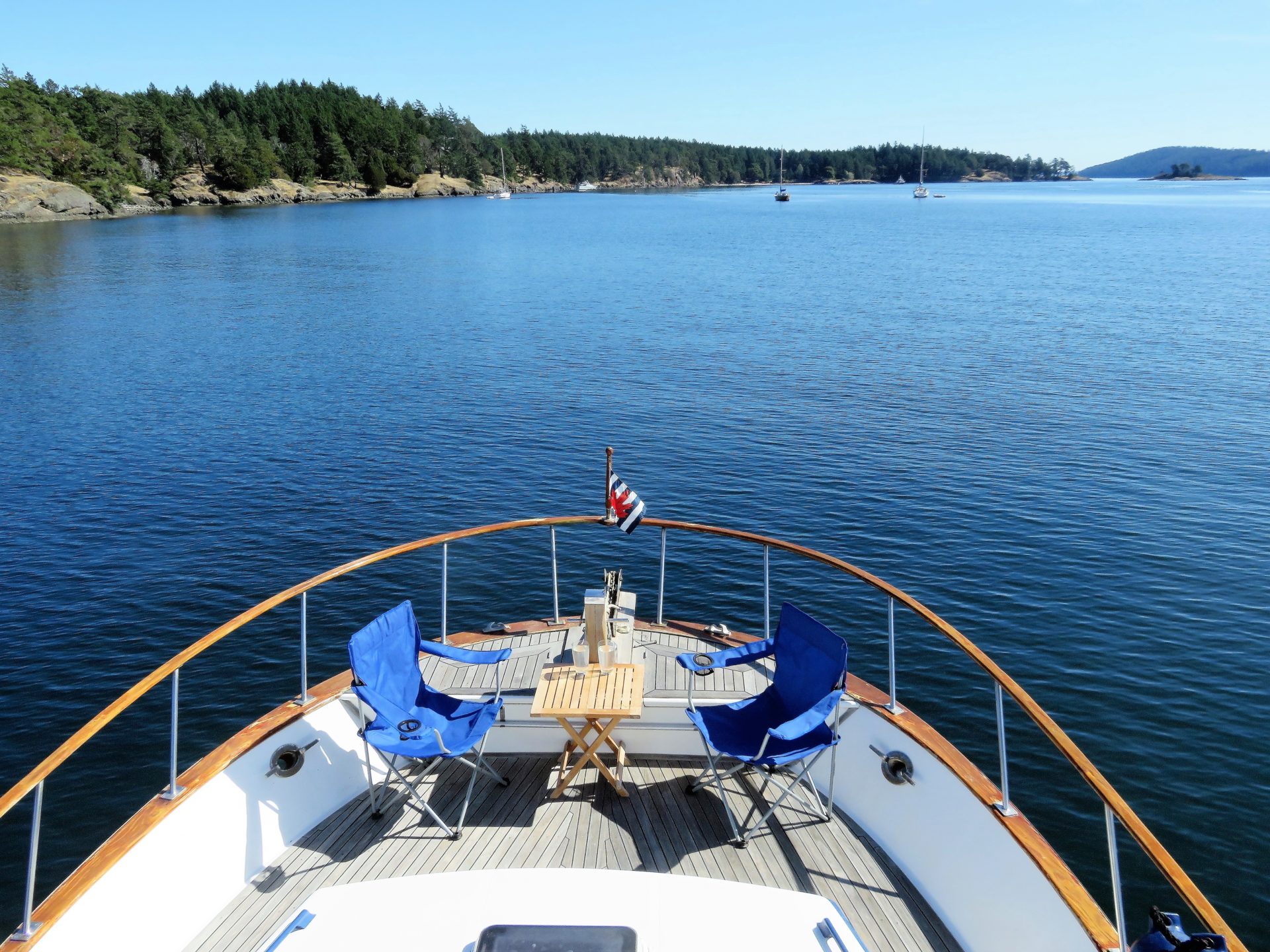 Relaxing at anchor in Reid Harbor.
The head of Reid Harbor is popular with kayakers. There’s a gravel beach to pull up on, and tent sites under the trees. In 2003 the San Juan Preservation Trust acquired the land where the campsites now stand. This 13-acre waterfront property had previously been a children’s summer camp, but had become derelict. Over a period of years, volunteers returned the property to its natural state as you see it today.
It’s a short five-mile paddle from Roche Harbor, so tours of novice kayakers, under the watchful eye of one or more patient guides, are often seen in the bay. Like cyclists on the road, pass with care—some are not as confident as they seem.
 Turn Point lighthouse keeper’s home.
Also at the head of Reid Harbor a road climbs through the forest to the west. Known locally as ‘the Hill,’ it’s a grade that captures your attention for 15 minutes as you gain about 250 feet of elevation. In the summer, the shadows from the tall trees are a relief as you stride up the gravel to reach the school (which closed in 2007 due to a lack of students). Close by there’s a water tap (appreciated on hot days) and a tiny retail outlet called the Treasure Chest, operated by a local family, the Bensons. A covered stand sells T-shirts and fleece tops printed with local Stuart Island themes. There’s no one in attendance—use the honesty box or mail in a cheque.
Congratulations, you’ve just done all the hard work. From the school, it’s a pleasant 1.5-mile amble (30 to 40 minutes) along the road to the Turn Point lighthouse—well worth the walk to see this national monument. Again, large trees provide welcome shade in the summer for much of the distance. On the way, open fields let you look east to Mount Baker and Prevost Harbor. A road from the Prevost anchorage joins the Reid Harbor road after a while. Beyond the junction you’ll parallel one of the island’s two airstrips, an undulating swath of grass that made us grateful to have arrived by boat and not by plane!
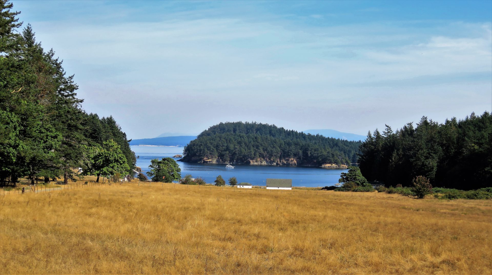 Near the airstrip, the view east to Prevost Harbor and Boundary Pass.
The final half-mile descends gently (uphill on the way back) to the lighthouse and buildings. Shortly before the headland comes into view, paths on the left lead to cliff tops overlooking Haro Strait, where there are views west to the Saanich Peninsula on Vancouver Island.
The headland is impressive, jutting out where Haro Strait meets Boundary Pass. Small cliffs drop to the water, and strong currents pump huge amounts of water past the shore, sending vortices spooling off into the sea. It’s not a place to fall in accidentally.
The point’s name derives from the obvious need for large vessels to make a 90-degree course change, whether coming from or going to the Port of Vancouver. The buildings are in good repair and date back to 1893 when the Light House Service was a force to be reckoned with, and built splendid homes and outbuildings for their keepers. They operated this important station with its increasing marine traffic until 1939, when the US Coast Guard took over. In 1974, like so many others along the coast, the light was automated. The property is now controlled by the Bureau of Land Management.
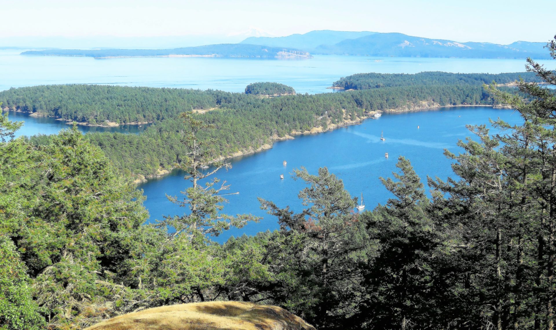 View from the far end of Tip Top Hill, looking east over Reid Harbor to Mount Baker 65 miles away.
WHAT’S IN A NAME?
Stuart Island was named by US Navy Lieutenant Charles Wilkes during the US Exploring Expedition (often just known as the Wilkes Expedition) of 1838–42 to honour Frederick D. Stuart, the captain’s clerk. This expedition, funded by Congress, comprised three warships, a supply vessel and two sloops that set sail on a trans-world voyage of exploration. They visited South America, the Philippines, South Africa, Australia, Antarctica and more. The scientists on board recorded geo-magnetism, oceanography, surveyed and produced charts, and studied the natural world. Their efforts pushed forward the US’s role as a world leader in science to a significant degree. Many of the specimens collected ended up in the Smithsonian Institution, founded shortly thereafter in 1846.
Stuart Island, WA should not be confused with Stuart Island, BC which lies at the start of Bute Inlet, adjacent to the somewhat famous Yuculta, Gillard and Dent rapids that separate southern cruisers in Desolation Sound from the more hardened mariners of Johnston Strait, the Broughton Archipelago and destinations north.
Prevost Harbor is named for Captain James Charles Prevost of HMS Satellite, one of two Royal Navy survey ships that were sent out to demarcate the boundary through the Gulf and San Juan Islands (the other was HMS Plumper under Captain George Henry Richards) in 1857.
Britain subsequently lost the border case when, in 1872, arbitrator Kaiser Wilhelm I of Germany (via a three-man arbitration board that he appointed) established the current international boundary through Haro Strait, making the San Juan Islands part of American territory; this despite Wilhelm being closely related to Queen Victoria of Great Britain.
Reid Harbor was named by Captain Richards of HMS Plumper after Captain James Murray Reid whose naval career was sadly not of the same trajectory as Captain James Prevost (above). Born in the Orkneys, like many Scots, Reid signed on with the Hudson’s Bay Company where he served 28 years. In 1861 while in command of the company’s Vancouver, the ship ran aground on Rose Spit in what was then the Queen Charlotte Islands. As the cargo, bound for Port Simpson (near present day Prince Rupert) comprised mostly of rum, Captain Dodd of the Beaver ordered the ship oiled and burnt to “prevent it being salvaged by the natives, thereby spoiling trade.” Captain Reid retired to Victoria at the age of 49.
If you don’t care to anchor in Reid Harbor, there are 12 mooring buoys suitable for large vessels, and a 500-foot line mooring system in mid-bay for boats under 30 feet. There’s also a hand-operated pump-out station on a barge located about 100 yards east of the public dock which is near the head of the bay. The pump-out is open year round.