
That was then… Some years ago, before we owned a boat, we became interested in Lasqueti (pronounced “luss-kee-tee”), a 30-kilometre-long island in the Strait of Georgia off the Sunshine Coast. The island was a bit of a mystery. For a start, the ferry left from an unmarked spot on Vancouver Island, the schedule was impossible to find via phone book or internet, and Lasqueti itself, although visible up and down the strait from many angles, had a reputation for being—well, unreachable.
To complicate things, there was no car ferry. True, there were rumored to be vehicles over there, but how they’d got there was another story. And there was no electricity. Really. The locals didn’t want it, and BC Hydro couldn’t sell it. And as for the local inhabitants…
The ferry took about 50 people, as well as 22-foot kayaks (which was a good thing). After a 50-minute crossing to False Bay, we stepped onto a bustling dock crowded with islanders, beer crates, dog food and bicycles. Lasqueti locals say there’s no Pacific Standard Time over there, only Ferry Time. Everything moves to the rhythm of that ship.
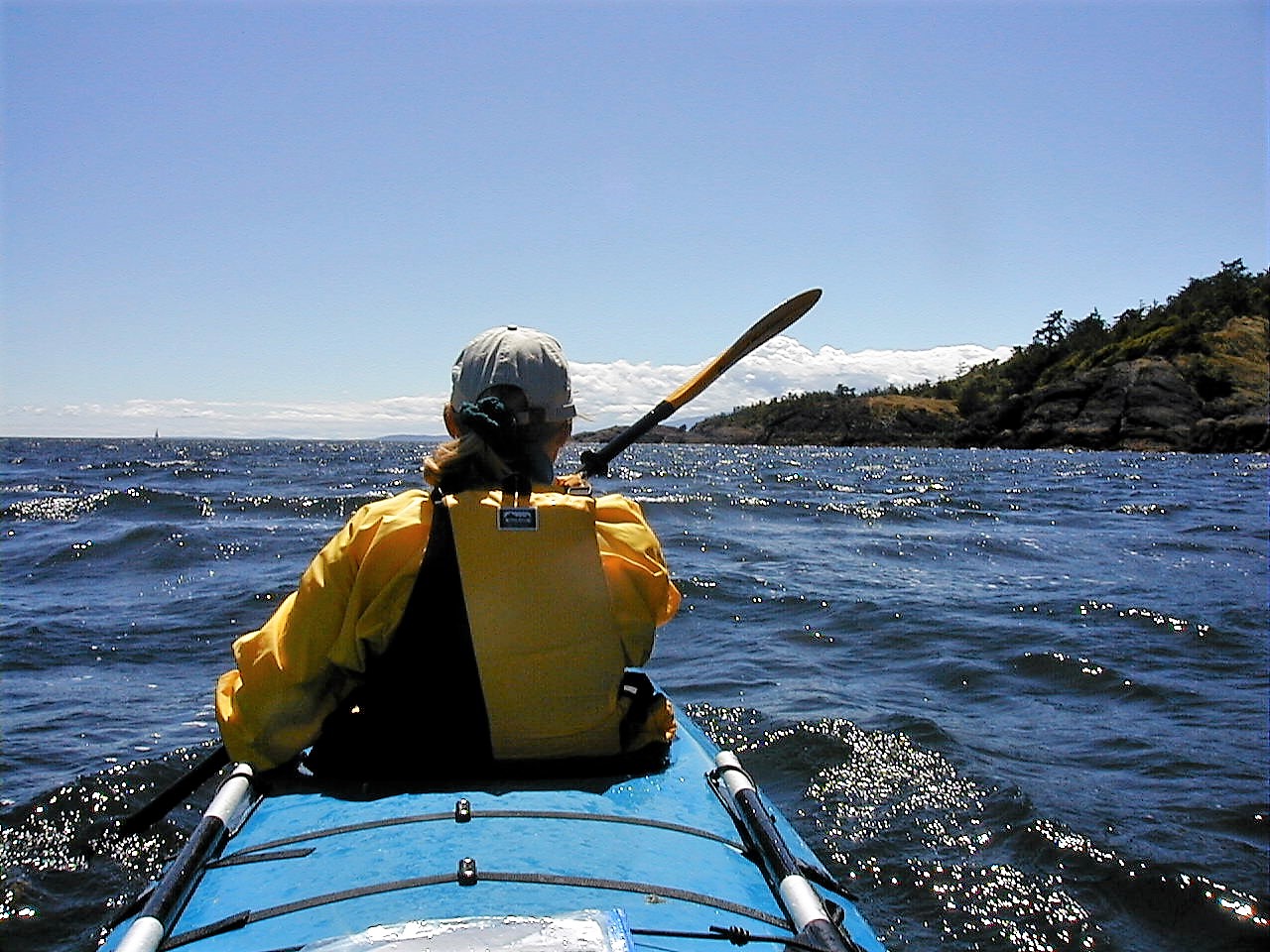
We launched our double kayak and paddled away from the crowds. Across the strait, Mount Arrowsmith stood clear and snow-splashed behind Parksville, with a cobalt sky beyond. It was going to be a great weekend. A westerly breeze started a choppy sea before we turned north into the lee of the Finnerty Islands, where the surface became glassy flat.
Lasqueti lies along the geological join between the Cascadia Plate (with Vancouver Island on it) to the west, and the North America Plate (with everything else on it) to the east. The east plate is moving towards Japan, and Cascadia (being a lot smaller) is moving toward Alaska. Lasqueti was born of fiery rocks that are obvious in the many black basalt cliffs that stand at its headlands.
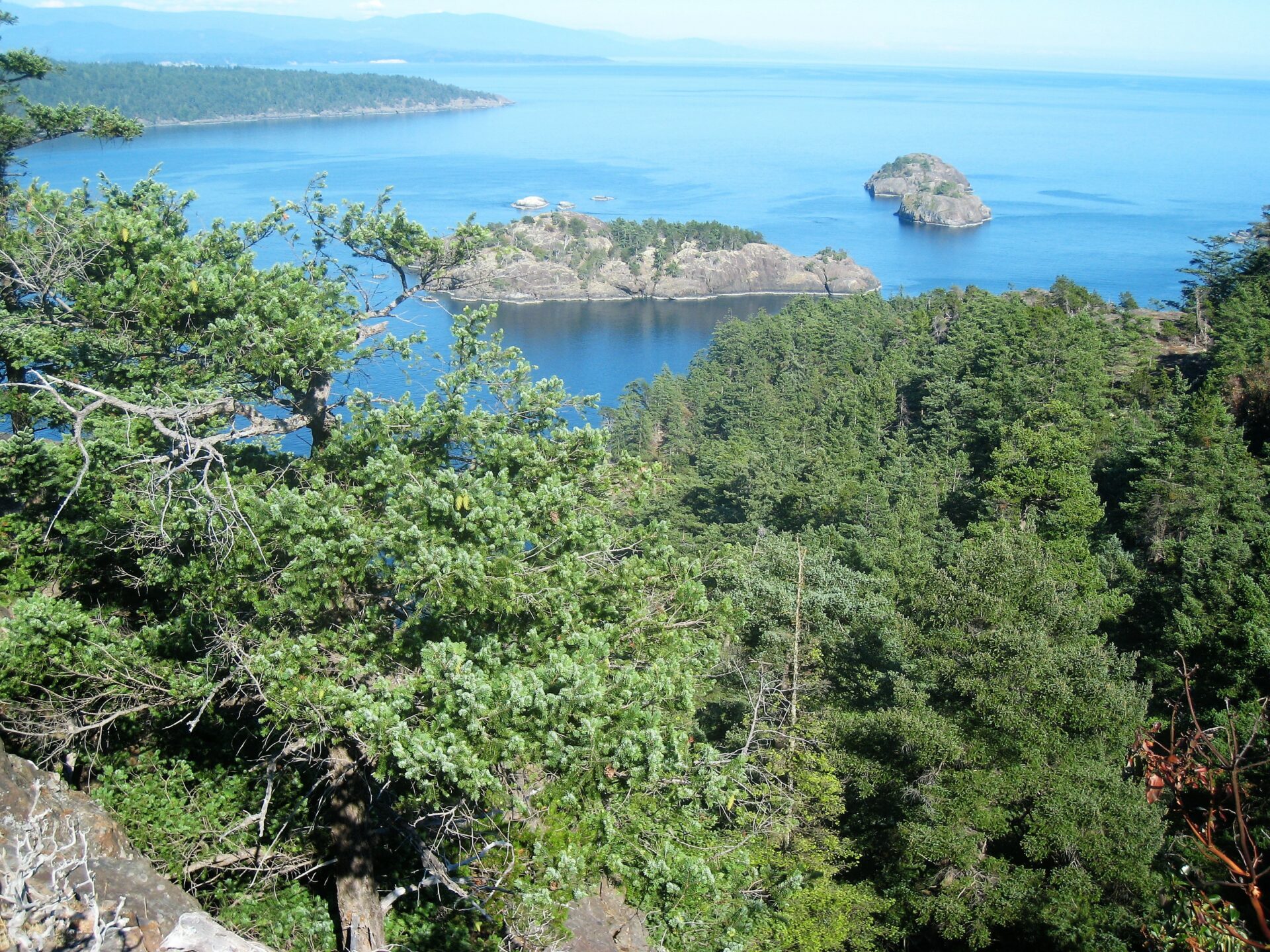
We turned east around the top of the island into Sabine Channel. Ahead, the huge forested flanks of Texada Island swept down from a high ridge, bare of roads or buildings. Finally, we felt away from it all. Ahead, the channel narrowed into an archipelago, the furthest of which was our destination—Jedediah Island Marine Park. We threaded our way through the channels, rock headlands and secluded gravel beaches. Trees crowded to the tide line as the kayak slid over the water.
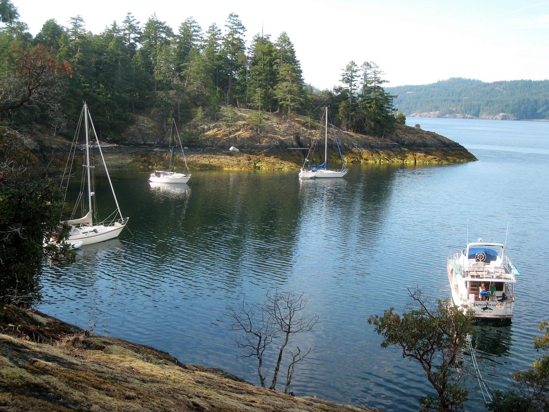
 Anchored in Skerry Bay.
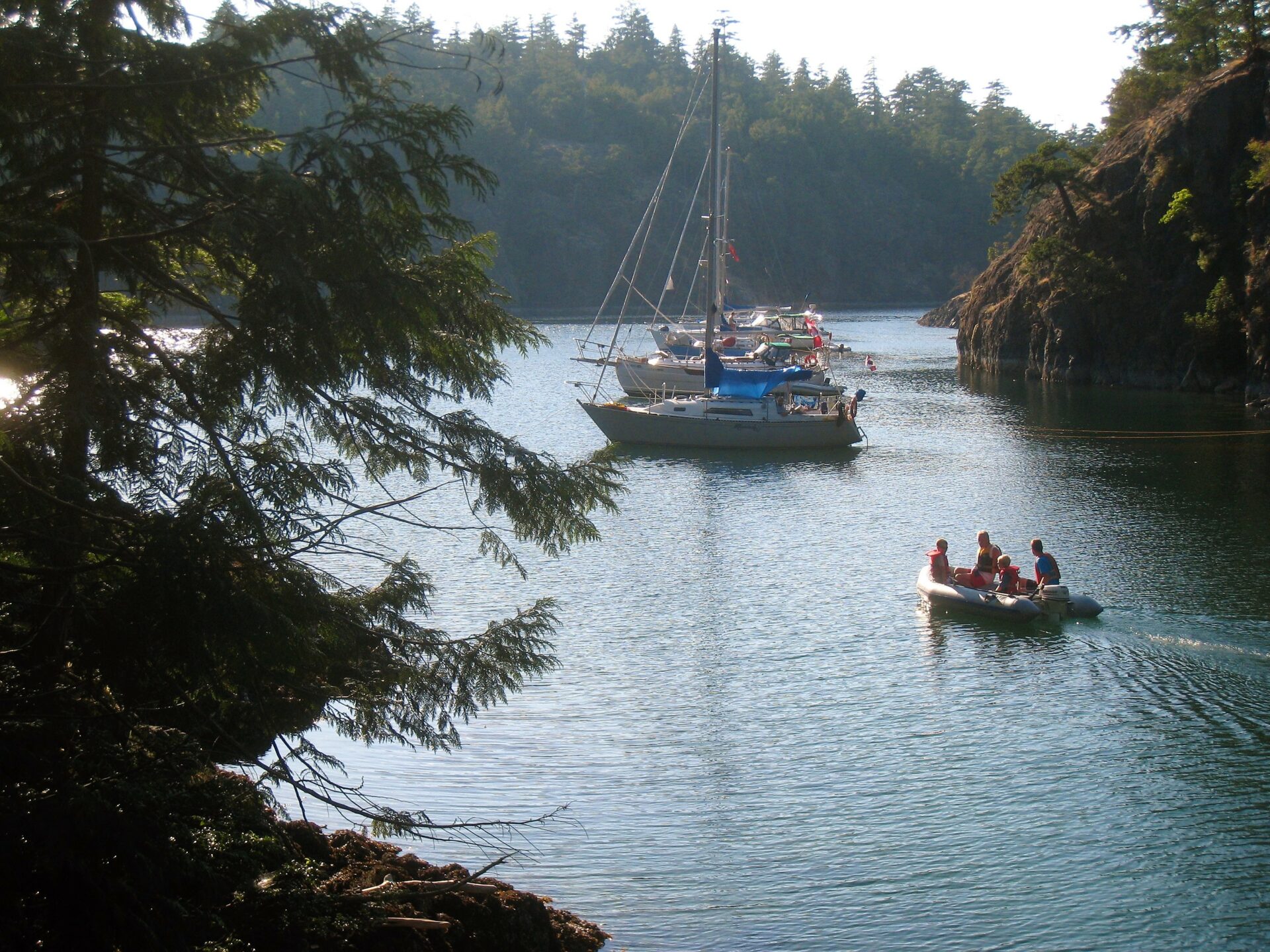
Jedediah’s north and south aspects are rocky bluffs, dropping steeply into deep channels. In contrast, the east and west sides have bays that allow access to hidden farmland in the island’s centre. Gliding into the sheltered waters of Home Bay, a narrow channel led to a protected harbour with a mud bottom—a narrow but popular anchoring spot for sailboats that transit to Desolation Sound to the north. That day, it was deserted.
At the head of the cove was the old homestead, occupied by the island’s owners Mary and Al Palmer from the 1970s to 1990s, until they retired. Faced with the choice of selling the island to a developer for more than $13 million, they offered it instead to the provincial government for a marine park, for a little over $4 million.
Where to find that sort of money? The Friends of Jedediah was formed, and Mountain Equipment Co-op and other groups banded together, trying to raise the funds. But it was a tragedy half way around the world, ironically, that made the project possible. Dan Culver, the first Canadian to summit both Everest and K2 (the highest and second highest peaks in the world), died on the descent of the latter. In his will, he left over a million dollars to acquire environmentally sensitive land for the public good. Inspired by this huge bequest, the provincial and federal governments came together with the public, and Jedediah was preserved.
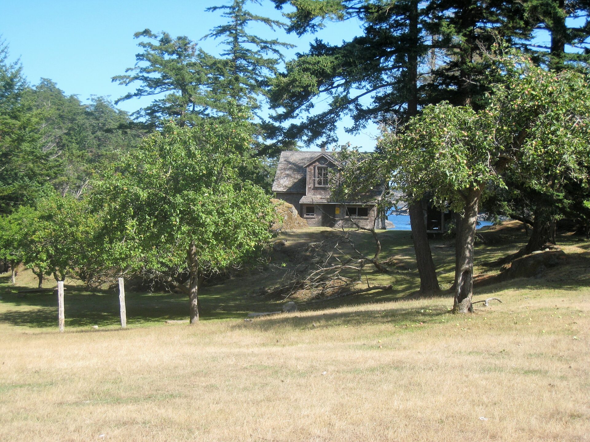 Part of the cleared fields and old homestead at Home Bay.
The old farm buildings still stand, but are closed and shuttered now. Flocks of feral sheep and goats used to keep the meadow grass at a reasonable level, but Parks have removed them now. Stained water trickles from a marsh. Old split cedar fences lean in rows, leading nowhere. Lines of mature fruit trees—chestnuts, apples—serve to remind you of an earlier time when this was a working farm.
On that first visit we camped at Home Bay on sheep-cropped grass. Above, the sky showed a few cirrus clouds. A horse, no doubt lonely for company, appeared. Some visiting child had plaited its mane into braids.
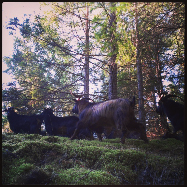 Feral goats!
It was twilight when the wind started. It came from the northwest, shrieking through the treetops and shuddering among the tall trunks. At ground level it went from calm to a fabric-humming tent in minutes. Warm in our sleeping bags, we listened to the rising gale.
We’d planned an early start to catch the tide, but at 7:00 the next morning the wind was howling, although the sky was cloud free. It was Sunday, and we had to be back in the office on Monday morning. How to do that, when the channels were strips of churning waves and driven spray?
Looking at the charts, we saw a jetty at Squitty Bay, at the south end of Lasqueti Island. Well, if there was a jetty, there’d be a road and houses. And if there were houses, we could find a phone to call a cab to take us to False Bay. And, with luck, we’d make the 16:00 ferry to Vancouver Island.
Our morning of procrastination meant the tide had dropped in Home Bay, leaving sand and mud. There was nothing for it but to carry all our gear, plus the kayak, far out to the water’s edge. Squelching through mud and then sliding over oyster shells, we finally became buoyant. Overhead, the wind screamed.
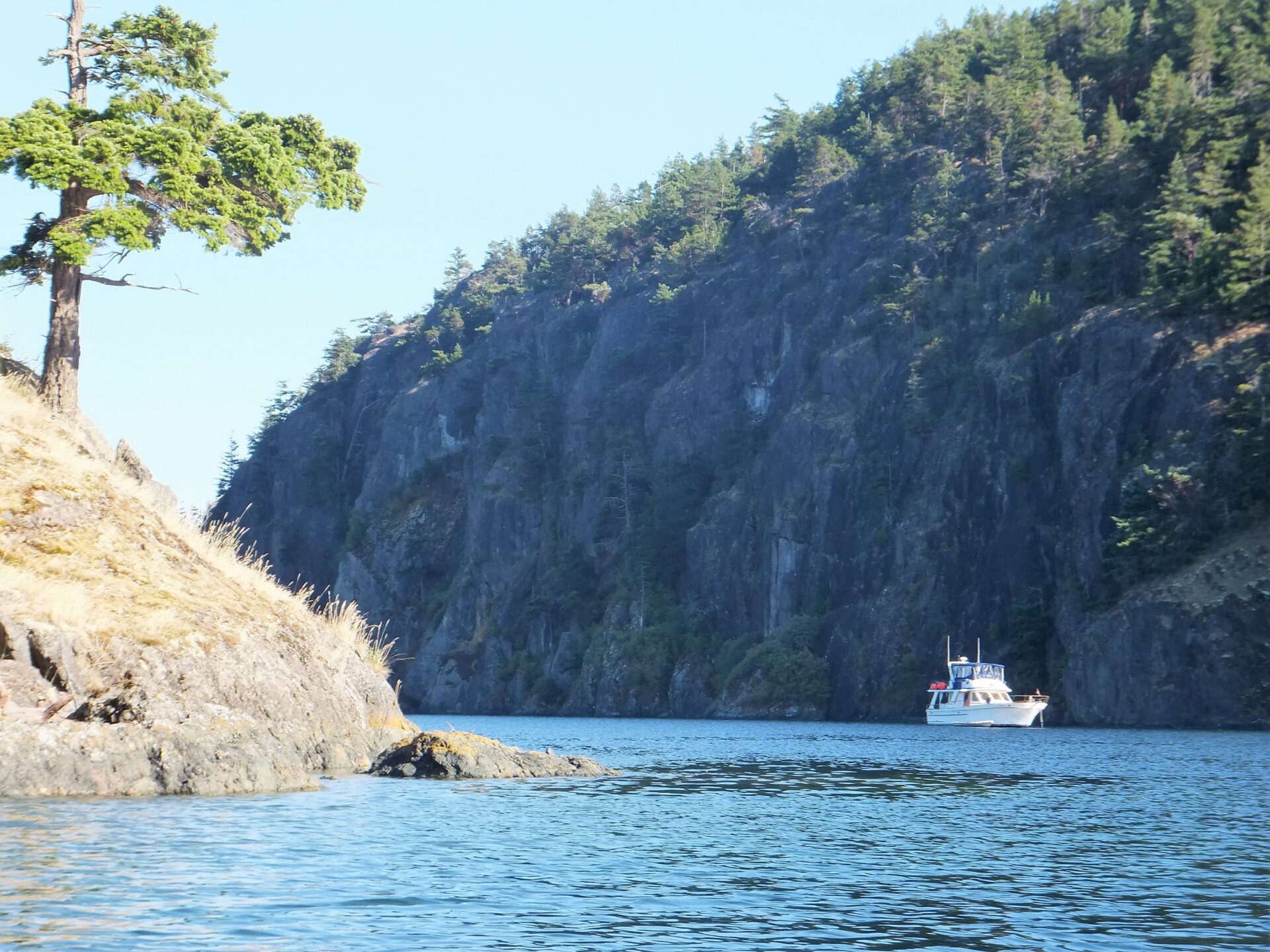
Spray skirts on—check. Rudder down—check. Deck cargo stowed—check. Hat chin-straps on—check. Ready. In the calm of the last headland, we paused and regarded Bull Channel ahead. It didn’t look too bad—no more than half a mile across. But the whitecaps were wild, and the swells surging off the rocks gave us pause for thought.
 Running for our lives from a northwester down Bull Channel.
Turning downwind, we struck the water with the paddles. Within moments we were into the surging sea, and the craft came alive under us, gaining a life of its own as we forged ahead. One moment our paddles would barely catch, then on the next stroke wrists would disappear underwater, as the waves rolled under and away. But the big touring kayak cut the crests, rose in every trough, and responded to the rudder. We were flying!
Already the rocky shore of Lasqueti was closer. We turned to put more of our tail to the wind, surfing down the swells. Clear of Bull Island, the full force from Sabine Channel could be felt, but we were now stern to the wind, and leaping forward with every paddle stroke.
So exhilarating was the ride, in fact, that we nearly made a serious mistake. In the spray-soaked conditions, it would have been easy to miss the turn into Squitty Bay. Just in time we spotted a small BC Parks sign on a passing headland and realized the blank rocks off to the right were our destination.
“Turn in! This must be Squitty Bay!” Swinging beam-on to the sea for just a moment, we lurched wildly into the lee of a reef, and then, as suddenly as it had started, we were in calm water again. At the quay, we had some luck—a large powerboat languished on its lines. The owner offered us his cell phone.
The hotel in False Bay didn’t have a taxi. “Stranded in Squitty, eh? Barry’s your man!” said the voice at the other end of the line. He rattled off a number.
More luck … Barry was home. We explained our predicament. “No problem,” he said. “When d’you want to be picked up?”
“Now is good.”
“Now?”
We waited an hour. I borrowed the cell phone and called again. “Didn’t realize you wanted to go right away,” said Barry. “Can’t pick you up right now. I’m doing my laundry.”
There’s Pacific Standard Time. And there’s Ferry Time. I reminded Barry of the latter.
“OK,” he said, “I’ll be there in 20 minutes.”
He arrived promptly, 45 minutes later. There was an air of unhurried calm about him. The taxi was a surprise, too. It was a tiny Suzuki Samurai with a dinky roof rack. Somehow, we managed to attach 22 feet of kayak to the four-foot frame. Then, on an island that boasted no paved roads and no vehicles, the 30-kilometre drive to False Bay took an age—when you’re negotiating potholes with a 22-foot boom fore and aft, you have to avoid bobbing.
Glancing at our watches, we were just thinking we’d make that 16:00 ferry when Barry dropped a gentle bombshell. “There was a pretty good rave at the community hall last night,” he said. “Lots of people came over from the mainland.” There was a long pause. “Most of them’ll be catching that ferry back.”
Our hearts sank.
“So I went down to the dock before I came to pick you up,” he continued, “to get you some boarding passes.”
Our hearts soared.
“But they were all gone.”
Our hearts sank again.
“But that’s often the way,” he said. “Usually, something turns up.”
I’m not sure our hearts knew what to make of that. We drove the rest of the way in silence.
The dock was its usual chaos of islanders, beer bottles (empty now), large dogs, and bicycles all returning to Vancouver Island. Barry helped carry the kayak down to the dock. Then he hung around. He seemed to know everyone.
The ferry arrived, and the already crowded jetty doubled in capacity. We clustered near the vessel’s on-ramp and watched passengers pouring onboard, each waving a precious boarding pass. Judging by their appearances, they’d had a great rave the previous night.
Then, just as it looked certain we wouldn’t get on, Lady Luck smiled. A woman appeared on the dock. “Oh, hi Barry!” she laughed. “Do you need a boarding pass? I’ve got two.”
Barry scooped them up before anyone could intervene, and handed them to us with one of his gentle smiles. “Looks like you’re on your way,” he said. I guess we were.
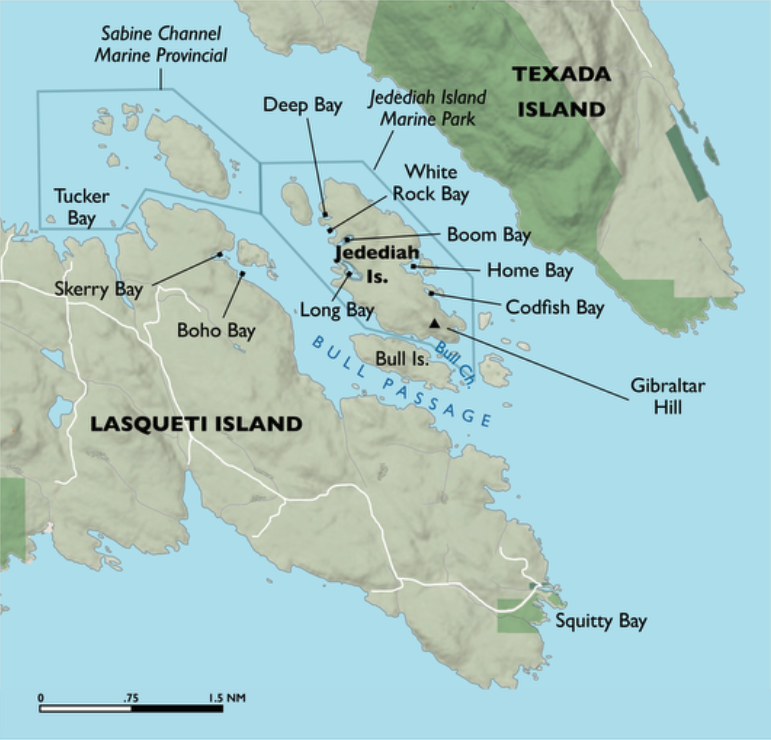
This is now… Fast forward a decade. We own a boat and have stopped at Jedediah numerous times on our way north or south. Being from Vancouver Island, we stage out of Nanaimo, cross Whiskey Golf (the military range off Winchelsea Island) and anchor in Deep, Boho, White Rock or Tucker bays, depending on the prevailing wind.
Jedediah Island has a number of fine walks where you can stretch your sea legs. There are trails up the heights on both the south end of the island (Gibraltar Hill, near Codfish Bay, is 150 metres high) and at the north end of the island (next to Deep Bay). The trails are well signed on the park notice boards. If you don’t like steep trails, avoid the trail up the east flank of Gibraltar. Approach up the easier north ridge.
On calm days, the entire archipelago is ideal for exploring in a dinghy or kayak. Little channels between steep cliffs, pocket white sand beaches (there’s a beauty in Home Bay, and another on West Point at the top of Lasqueti), plus excellent fishing. And then there’s the wildlife.
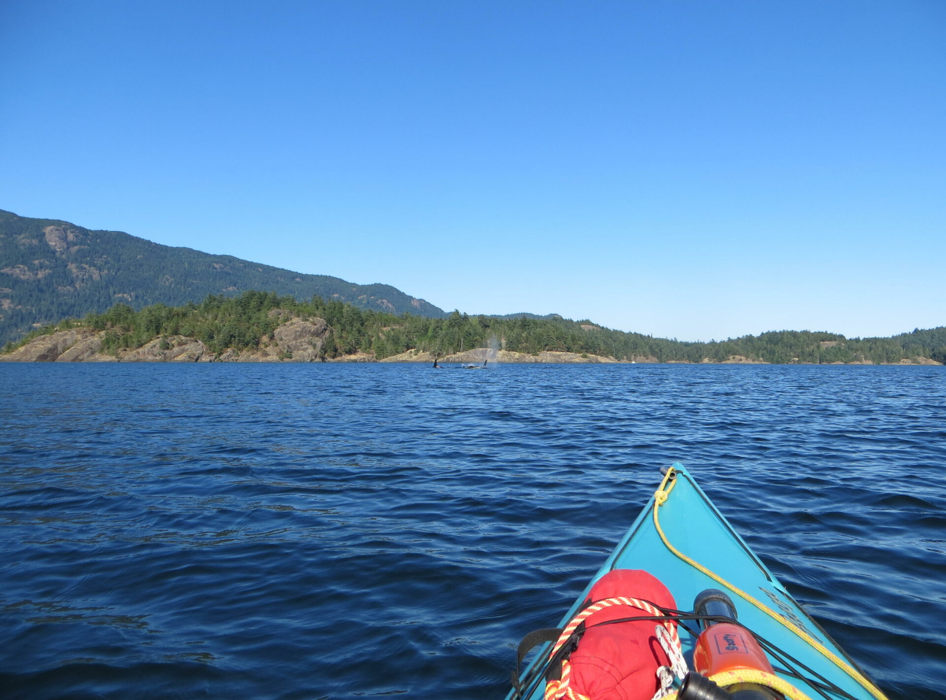
Crossing Bull Passage one day in kayaks, two of us heard the sound of orca some distance off to the south. Initially their position wasn’t obvious. Kayakers sit low to the water and visibility is limited. Then we saw them – a pod of about 10 whales coming toward us.
 Sierra Exif JPEG
We’d both recently seen the movie “Blackfish.” True, there’s never been a documented account of a free orca attacking a human on the water, but the transients sure can dispose of seals, dolphins and even whales in short order. Big males weigh up to five tons and move at over 30 knots. Suddenly, the shore looked a long way away, and the 14-foot kayaks felt very small.
There was no way we could avoid the meeting. They were about half a mile away, moving steadily in our direction. Small and large dorsal fins rose and fell, the familiar sound of their breathing coming clearly on the calm air. It was like watching the approach of a ship’s bow at high speed, and there was nothing we could do but wait. And hope.
Now we could plainly see the pale patterns on their backs, and watch the water as it rose, flowed over their bodies and then closed again when they submerged. The spray of their breath hung in the air. We glanced at each other, both trying to put on a brave face. What would they do?
What they did was unexpected. When the gap between us had closed to 100 metres, the sounds of their breathing stopped. It was eerily silent, as if everything was holding its breath. Were they about to attack? Where were they?
The silence lasted minutes as we waited anxiously. Then a blast to the north made us spin around. There they were, still in Bull Channel, still northbound, only they’d simply passed below us. How did they know we were there? We hadn’t made a sound. We were barely breathing! Yet they had sensed something was ahead and had quietly avoided us. It made sense; water’s their medium, their home. Most likely they’d known about our presence long before we’d even heard them.
With considerable relief, we paddled back to our boat, in awe of the brute power and subtle intelligence of these great creatures. We never transit Bull Passage these days without remembering that encounter.
Jedediah Island Anchorages Jedediah Island and the east shore of Lasqueti Island have high rock bluffs that provide valuable shelter from a prevailing wind, but boaters should take care because those same bluffs can funnel blasts coming from other directions.
 Deep Bay in Summer.
Deep Bay at the north end of Jedediah is a favourite anchorage, especially in a southeaster. Even in a northwester, high Paul Island offers some lee cover. The bay is small and narrow. Stern tying is necessary. If you arrive and find the bay apparently full, it’s worth going down to the south end to have a closer look. The bay is deceptive—there’s often good anchorage far in beyond the other boats.
 White Rock Bay.
White Rock Bay is open to the west and northwest, and to boat wakes that run up and down Bull Passage, but we have anchored there successfully (there’s always room) and access to the trails leading to the farm are best gained there.
Boom and Long bays look good on the charts, but dry at low tide and are oyster farms. Avoid.
Codfish and Home bays provide anchorages for smaller vessels in a northwester, but are vulnerable to anything from the southeast. Check your chart—Home Bay dries quite a distance down the channel between Mother Goose and Lasqueti islands, but does provide quick access to the old farm and orchard. Cruise ships often transit Sabine Channel just to the east. It’s a strange thing to be woken after midnight by slowly passing lights reflecting through your portholes onto the ceiling, accompanied by the deep thump of bass speakers from the nightclub!
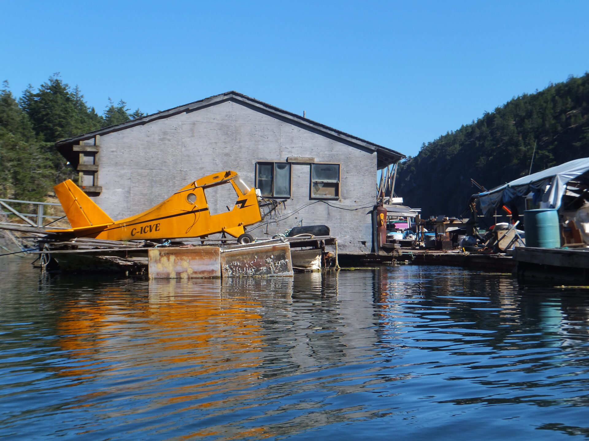
Skerry Bay behind Boho Island on Lasqueti is good in a northwester with high bluffs to the north. The back of the bay is cluttered with float home barges, and since the bay has been used for decades by tugs, anchor with caution to avoid foul hooking cables or logs.
Tucker Bay on the north side of Lasqueti Island comprises a number of nooks and crannies which suit calm nights or light southeasters. In the summer we’ve had issues with mosquitoes there (not at the other anchorages). Strong currents run west and east between Lasqueti and Texada Island. Make sure you’re well inside the shore shear line.
South Winchelsea Island
In 1998 The Land Conservancy of British Columbia (TLC) purchased the 10.4-hectare South Winchelsea Island, one of four in the archipelago that are privately owned, with the other 15 being Crown Land. Located off the mouth of Nanoose Bay, the island had been identified for protection, as it was recognized as a good example of the endangered Garry oak meadow ecosystem, which is only found on southern Vancouver Island.
Under the gnarly Garry Oaks and red-trunked Arbutus, visitors may find rare spring wildflowers and plants including the camas lily and chocolate lily. South Winchelsea Island also offers opportunities to see bald eagles, black oystercatchers, harlequin ducks, and many varieties of gulls.