
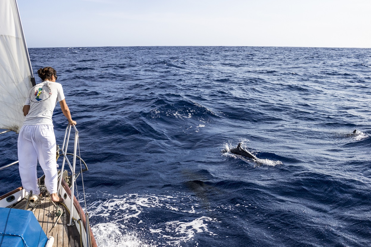
 Watching dolphins play off the bow.
Crossing the Pacific Ocean to the Polynesian islands is generally considered the “coconut milk run,” an easy downwind passage in the warm weather of the tropics and the consistent breezes of the trade winds.
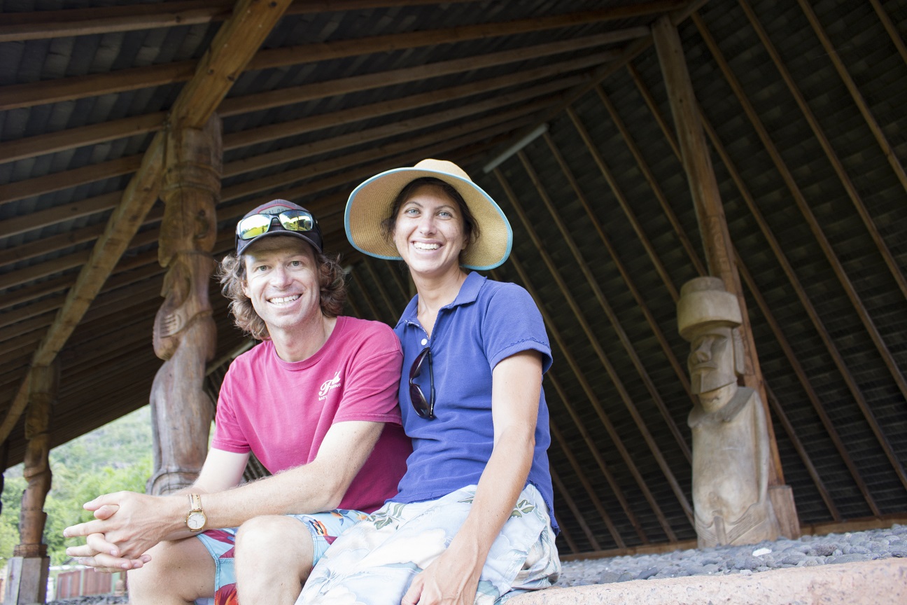
My husband Seth and I first crossed the Pacific when we were 24 and 21 years old respectively, and we had a lovely “coconut milk run.” This experience fully reinforced everything we’d read and heard. Fellow sailors we met in the Polynesian islands related similar tales of pleasant passages and downwind runs.
So, it was with some surprise that Seth and I studied the weather forecasts for our second Pacific crossing and saw strong headwinds. The idea that this is a milk run was so ingrained, and had been so confirmed by our first trip, that we could hardly believe the GRIBs and PassageWeather charts. We’d spent the past five years in the high latitudes and were ready for a bit of a change. We wanted this passage to be like our first Pacific crossing.
 In Atuona.
On that first voyage, we started from Panama on May 1, 2007, after having transited the canal. We first made an uneventful 10-day passage to the Galapagos. Our boat was old and primitive, so once we left the internet cafe in Panama City, we had no way of receiving weather forecasts. We were on the southern edge of the Intertropical Convergence Zone (ITCZ) for most of the passage, but were fortunate in that its conditions were mild throughout the trip. Each day was overcast and punctuated by rain squalls, none of which were terribly strong and none of which were, fortunately, accompanied by lightning.
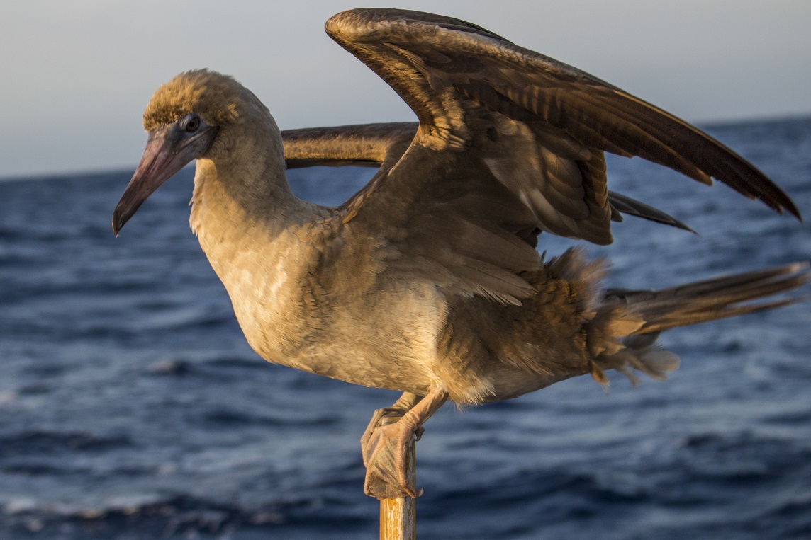 A juvenile booby hitches a ride.
After two weeks of marveling at the Galapagos wildlife, we set off from Santa Cruz Island on May 25, bound for Hiva Oa in the Marquesas—the classic trans-Pacific route. On our first afternoon, the sun glittered on a placid ocean ruffled only by a light easterly, and these conditions continued for several days after the large island of Isabella had dropped below the horizon. There was a swell from the southeast, so long and regular as to be hardly noticeable as long as there was wind. We set our symmetrical spinnaker and ran just south of west, right on course. On our third day of flying the ‘chute, the wind suddenly fell light and we bobbed in the swell and wind-waves so that the spinnaker wrapped around the forestay before we could douse it. Seth went up in the harness to untangle it and thereafter we contented ourselves with the mainsail and poled-out genoa. In any case, the wind returned a little stronger so that the wing-on-wing sail plan was sufficient.
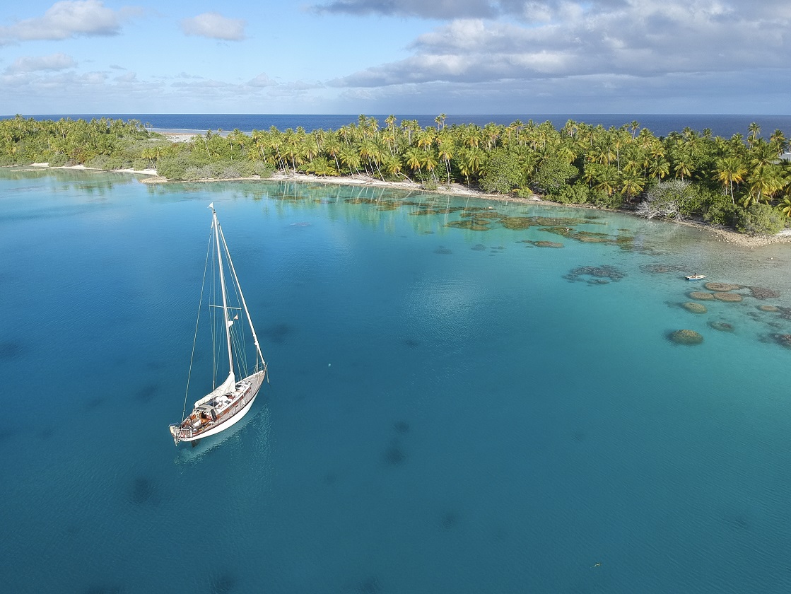 Tuamotu anchorage.
The remainder of the 3,000-mile crossing was the kind that all offshore sailors appreciate, the sort of passage of which there is no story to tell. That phrase, “no story to tell” is how our friend Pat Hahn, resident of Nome, Alaska and crew member on a Northwest Passage transit in 1972 to 1980 by walrus-skin umiak (open Inuit boat), describes a successful Northwest Passage voyage, made without incident. But it’s an apt description of any voyage, in the Arctic or elsewhere, that’s completed with careful planning and seamanship.
For the first two weeks, we ran before the light east-southeast wind. When the wind came too far aft, we would come up enough to keep the windvane working well. This meant that we had to jibe every few days in order not to stray too far from our course, but it was much more pleasant. The penciled marks on the chart marched along regularly (if a little slow) at 100 to 120 miles made good per day. The only issue was that Seth and I were both getting fatigued by our traditional four-hour watch rotation, so we decided to change it to four hours at night and six during the day, with four hours at midday when we shared the watch. Contrary to what many people have asked me, loneliness can often be more of an issue for a shorthanded crew on a long crossing than friction and conflict (though loneliness is usually forgotten on tough, windy passages), so these four hours in the middle of the day were our “together time.”
The second two weeks of the crossing were a little more eventful. We encountered rain squalls almost every night. Some of them were quite strong and, especially on cloudy nights in the moonless hours, it was hard to see them coming and shorten sail in time. One of these, that caught me unawares during my graveyard watch, somehow managed to break one of the hooks at the gooseneck where we attached the tack of our reef points, so that reefing down took some minor jury-rigging for the rest of the passage. That this was hardly a problem, however, is evidenced by the fact that we continued using our jury-rigged system all the way to New Zealand.
Mostly, we remember the passage for the vault of stars, sometimes shot through with the bright trails of meteors, for the glowing sunsets sometimes with a flourish of green flash, for the welcome sunrises just when we were getting sleepy on watch, for the flying fish shimmering over the waves and for the relaxing hours spent reading in the shade of a sail. We sailed the entire way, never using the engine. Our wind generator, which we’d installed in Panama, kept pace with our power consumption despite the light wind, although this was almost certainly due to the very basic nature of our boat and the fact that we had practically nothing on board that drew power. Our provisions lasted well despite our lack of refrigeration, and the consistent light trade winds meant that our inability to access weather forecasts was no problem. The only repair en route was to renew some stitching on the mainsail that had rotted away from too much sun exposure, and the only rough weather was the short-lived rain squalls that came as we approached the Marquesas. All in all, one couldn’t ask for much better.
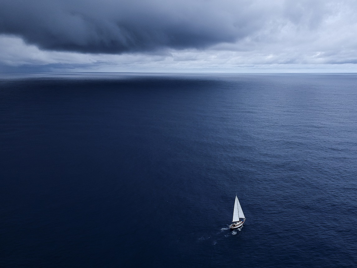 Celeste in the doldrums.
From this experience and the general opinion of the Pacific milk run, we expected to find similar conditions on our second trip, from Cabo San Lucas, on the tip of Mexico’s Baja Peninsula, to the South Seas islands. We may well have done if had we left in March, when the Pacific Puddle Jump participants leave, usually from Puerto Vallarta or other points on mainland Mexico. Unfortunately, due to work commitments, we were unable to leave Baja until the middle of May when the pilot charts showed increased wind strength south of the Intertropical Convergence Zone and from a markedly more southerly direction. All the weather forecasts agreed, showing a thick band of ITCZ, over 300 miles wide, followed by strong southerly headwinds that extended another 15 degrees (900 miles) south, albeit tapering and backing a little as one sailed west. The temperatures might be warm, but it would be no milk run in any other sense.
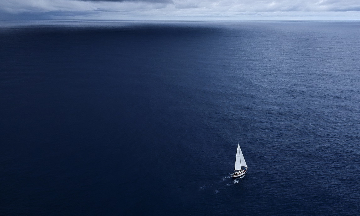
We sailed out of Cabo San Lucas on May 16, 2018 in a 25-knot westerly, with our cold-molded wooden cutter Celeste rolling heavily in the sloppy chop hitting her right on the beam. Because we had already been to the Marquesas, we had decided to see something a bit different if the wind would let us. Lonely Pitcairn Island, below the Tropic of Capricorn and home to the descendants of the Bounty mutineers, appealed to us, and if the wind angle was too southerly for that, we could always fall off for the Gambier Islands of French Polynesia. If the wind still didn’t serve, we’d fall off for the Marquesas.
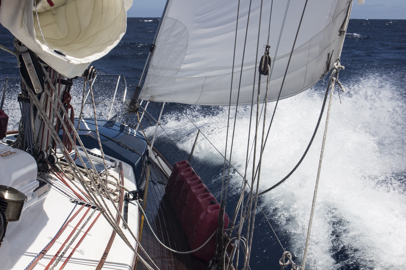 Hard on the wind, we buried Celeste’s bow on our second Pacific crossing.
We set our course due south from Baja in order to stay far enough east so that it might be possible to point the course for Pitcairn once we reached the southeast trade winds. After that first night of strong westerlies, the wind eased and veered into the northwest and eventually north, so that we had an enjoyable, if very hot, six days with which to begin the passage. We established a pleasant shipboard routine that included ceviche lunches made from an ono we caught and seawater bucket showers anytime the heat felt too much. We watched dolphins play in the bow wave and a juvenile booby rest for the night on our stern. We began to convince ourselves that we might have another milk run after all.
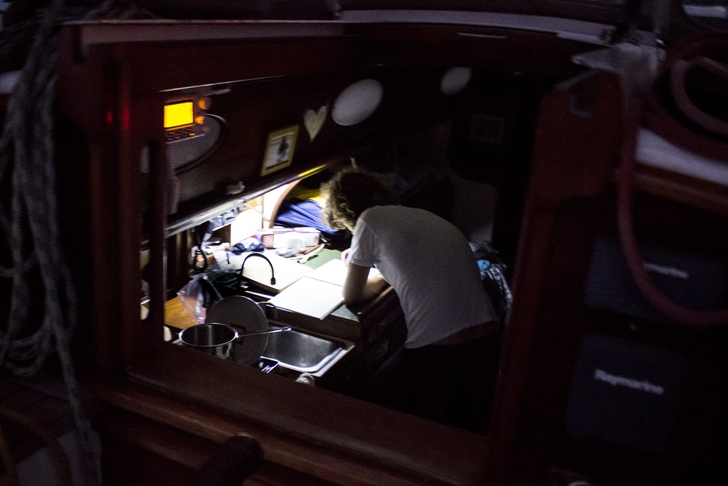 Night watch.
As anticipated, however, we hit the ITCZ around 10-degrees north. It welcomed us with thunderheads on every side, flashing ominously with cloud-to-cloud lighting. Fortunately, the doldrums improved somewhat after that, with the squalls a bit farther apart and less electrified. The sultry air and mirror calms broken by rain squalls continued, however, for the predicted 300 miles. On this crossing, we were receiving forecasts through OCENS WeatherNet, having equipped Celeste with an Iridium phone and OCENS Sidekick router/firewall. We had also prepared for this big belt of ITCZ by doubling our fuel capacity with 12 five-gallon jerry jugs on deck. So, we were able to motor through the calms rather than drift for days, potentially in the path of lightning.
While there were lovely moments in the doldrums—rainbows, a juvenile gull resting on our foredeck having been blown west of his migration route—both of us looked forward to getting through them and being relieved of the stress of thunderstorms. So, initially, it was with relief that we crossed into the strong southerlies. The clear skies, cooler air and wind for the sails felt great. After about three days, however, the violent motion of beating against 25 knots in steep seas began to tire us. Furthermore, the wind was so much on the nose that we were unable to point the course for the Gambier Islands, let alone Pitcairn. We also prefer not to strain Celeste unduly and incur unnecessary repair costs (in both time and money). So, we decided to aim for the Marquesas. This did not in fact change our course appreciably: because we couldn’t point to the Gambier Islands, remaining close-hauled to the southwest put us on course for the Marquesas. For the 11 days we were in the southerlies we sailed close-hauled with three reefs in the main. This was hardly a repeat of the Galapagos-to-Marquesas passage we had sailed in 2007.
One can adapt to almost anything, though. Celeste was heeling, rolling and pitching hard against the southerly—even a bit southwesterly—wind-waves, a southeast swell (from I know not where, given there was no east in the wind) and a large southerly swell generated by a big low in the Southern Ocean. For a few days we also had even steeper waves when the south equatorial counter-current flowed to the east and set at 90 degrees to the wind. Then finally, three days out from the Marquesas, the wind came aft and we got to pole out the jib in that classic trade wind sail plan. The squalls we remembered from our first crossing returned at night, but they weren’t bad, and we reveled in the flatter decks and easy motion. We were nearly there, having sailed 3,000 miles (we’d added 400 to the rhumb line route by trying to go to Pitcairn) in 23 days. Not bad for a boat with a 28-foot waterline, we thought. With almost eerie coincidence, we made landfall on Hiva Oa in the same conditions as we had 11 years previously, at dawn amid broken clouds and mist, giving the islands that beguiling mysteriousness that is so closely associated with the South Seas.