
It was the day of the summer solstice when we topped up our fuel in Venture, a Fleming 65, and departed Port McNeill for the Queen Charlotte Sound, heading for Haida Gwaii—a group of islands previously known as the Queen Charlottes. The water was glassy calm with plenty of floating logs to watch out for, especially along the tide lines. Once clear of the islands north of Vancouver Island, the sea became rougher—on the nose as usual—but not too bad given the reputation of this strait.
Landfall We [HOW MANY PEOPLE?]travelled overnight standing watches of two hours on and four hours off as we crossed the sound. The seas were confused and lumpy but calmed slightly once we were under the lee of the islands of Haida Gwaii. By the time I came on watch at 6:00 it was full daylight with the islands grey and misty off to port with the higher peaks still wearing snowy bonnets. By 9:00 the sun came out and the silvery, light blue sky and broken cloud made the island chain seem almost magical, an impression enhanced by the knowledge that the area we were passing was virtually uninhabited.
We originally planned to go some distance north of the airport at Sandspit before turning south to follow the buoyed channel but decided to cut across the bank that lies to seaward of the entrance. Over the land there were showers with strange, curtain-like tendrils of cloud hanging above the Haida settlement of Skidegate.
We tried calling on the phone and radio with no response. The small marina was crammed with mostly commercial boats so we dropped the anchor off Queen Charlotte City (also known as the Village of Queen Charlotte) after 29 hours and 13 minutes underway—giving us an average speed of just under nine knots for the 260 miles. We launched the tender and walked a short distance to the visitor’s centre, which stayed open until 21:00.
Haida Gwaii consists of a couple of main islands plus about 150 smaller ones—though the numbers vary depending on the source. Almost all of the population of 3,800 live on Graham Island, which is the northerly of the two main islands. The principal town of Queen Charlotte is located here as is the nearby settlement of Skidegate. One road leads north to a handful of small towns including Old Masset.
Moresby, the southern of the two main islands, is almost uninhabited with the bulk of it taken up with the Gwaii Hanaas national park. A visit to Gwaii Haanas requires prior attendance at an orientation course held at the museum. We had read in the literature that no appointment was needed and the museum opened at 10:00. So, the following morning we took the tender to the ferry terminal at Skidegate and then walked one kilometre to the museum, arriving just after 10:00. Here we learned that orientation was in fact at 9:00 every day Monday to Friday. Another crewmember would be joining us on Sunday and, as every person must attend orientation, this meant we had to return on Monday morning.
We paid all the various fees, which amounted to C$117.70 per person for the time we planned to spend in the Gwaii Haanas national park and came away with plenty of literature and a DVD.
The original Haida population numbered about 10,000 at the height of their power in the early 19th century. Their way of life and influence over the region earned them the description as the Vikings of the Pacific Northwest. Their seafaring ability in open canoes, fashioned from the trunk of a single cedar, enabled them to raid villages on the mainland bringing home booty and slaves to support their well-developed culture. This came to an abrupt and tragic end in the 1800s when about 90 percent of the population were wiped out by small pox and other diseases brought to the islands through contact with European traders hungry for sea otter pelts for trade with China.

The Orientation The following day we hired a taxi to drive us up to the northern tip of Graham Island. We had a chatty Haida driver who told us much about life on the island including the odd fact that the Haida people on Haida Gwaii are wards of the Queen of England! [HOW IS THIS?]
The following day, our friend George’s flight from Vancouver landed at Sandspit airport on the northern tip of Moresby Island. The shuttle brought him by ferry across to the marina in Queen Charlotte City. We enjoyed a meal of roast beef and Yorkshire pudding at the Ocean View Restaurant where, it seems, they follow the British tradition of serving roast dinners on Sundays.
On Monday we took a cab to the museum for our joint orientation, which lasted a couple of hours. Gwaii Hanaas is virtually the only place where the environment is protected all the way from the peaks of the mountains to offshore waters, and they take this protection very seriously. We had to fill out forms listing our personal details in case of an emergency and were given our permit numbers. Orientation for each participant is good for three years.
Literature handed out during the course makes the situation very clear:
“Facilities in and around Gwaii Haanas are minimal. There are no roads, stores, or fueling facilities. Access is limited to boats and floatplanes. Gwaii Haanas does not maintain hiking trails in the area. There are a few mooring buoys, two water hoses and limited navigational aids. Make daily travel plans flexible to accommodate delays caused by poor weather conditions. Bring enough fuel and food to sustain you for a few extra days. Carry clothing and equipment for a variety of weather conditions. This area has significant tidal variation, strong currents, rapidly changing weather, and strong winds that develop with little or no warning.”
Before returning to Venture we visited the Co-op supermarket where we took on extra provisions. The contents on the shelves of supermarkets in this part of the world tend to ebb and flow, like the tides, according to the schedule of the ferry bringing in supplies.
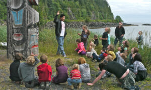
Taking the Tour The following day we made our way to the first official site at Skedans, 10 miles away. Each of the official sites has a resident watchman responsible for protecting the site and acting as a guide. A maximum of 12 people are allowed ashore at one time and the watchman should be called on the VHF [WHAT CHANNEL?] at least one hour ahead of the desired landing time. Skedans had once been a prosperous village but all that remains are the decaying remnants of toppled totem poles, which by local custom are left to be reabsorbed back into the natural environment.
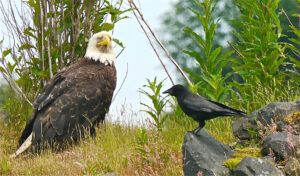
From here we moved on and anchored that night in Pacofi Bay. We left early the following morning and kept our eyes peeled for bears. In narrow Dana Passage, our vigilance was rewarded when we spotted a black bear foraging along the shore.
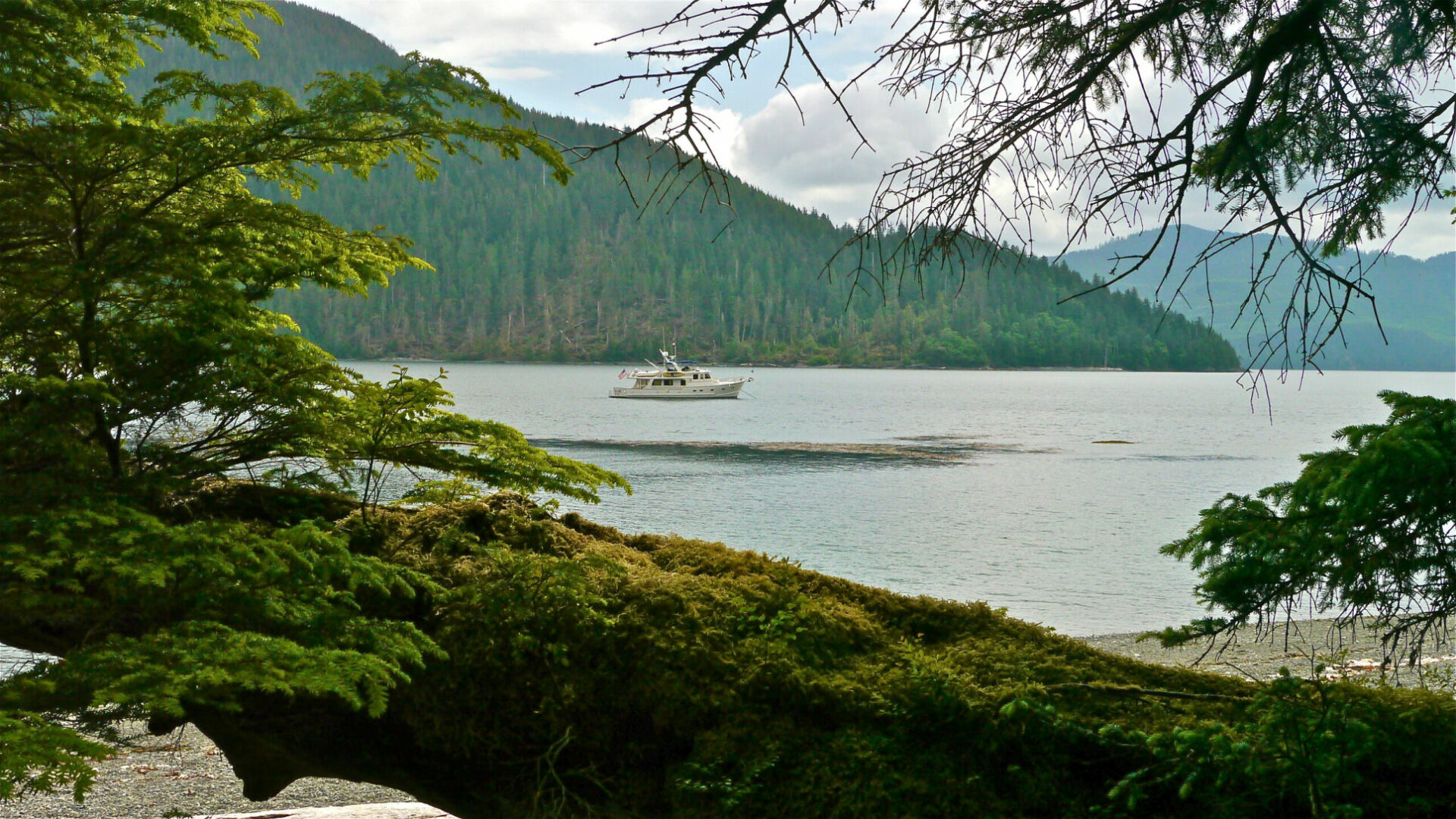
Our next stop was at Tanu Island where we anchored just off the beach. On previous trips we had been frustrated by our inability to make beach landings in the big tender, so for this trip we had added a smaller, flat-bottomed boat. Without it, getting ashore would have been next to impossible in Gwaii Hanaas because none of the sites had any form of dock or jetty.
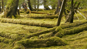
Here we were greeted by Frank the watchman. He was living on this site for one month with his wife, 11 year old daughter and small dog named Cedar. Frank was of Haida ancestry and very informative. He guided us along a trail marked by white clamshells. All that remains of this once-prosperous village are the decaying remains of fallen totem poles. We learned the difference between house poles, mortuary poles, memorial poles and poles with rings marking the number of potlatches a person had held in his lifetime. House sites of the elite could be identified by sunken pits and fallen beams. Everything was covered in a rich green blanket of velvety moss—soft and springy to the touch.
We next moved nine miles to Windy Bay where we picked up a mooring. The watchman, Al, had turned 76 in March but didn’t look his age. We signed the visitors’ book and Al took us on a hike through woods rich with large cedar trees. Again, moss covered everything. This track was quite rough with a number of diversions caused by the previous winter’s blowdowns.
The anchorage here was quite exposed, so we moved to Sedgwick Bay for the night and the following day continued on to Section Cove on Burnaby Island. The weather had turned grey and rainy with low clouds draping the forested slopes. During a break in the showers we went ashore for an afternoon of beachcombing and taking photos. The mossy forest comes right to the edge of the beach with its bounty of shells, seaweed and miscellaneous bric-a-brac. Like the vast majority of Gwaii Haanas this was not a watchman site and many happy hours can be spent just poking around examining flotsam and jetsam and the minutiae of nature.
The following morning we moved to Hotspring Island where we had a rendezvous with a floatplane from Queen Charlotte City to take George back to Sandspit airport. It rained all day so photography was pretty well out of the question and there was little incentive to go ashore and visit the hot springs.
Communications in Gwaii Haanas are almost non-existent, being restricted to VHF line of sight with the few and widely spaced watchman sites. We did not have a working satellite phone on board, which turned out to be a mistake. Anyone visiting this area would be strongly advised to carry a satellite phone.
With the weather looking so chancy we were concerned the floatplane might not be able to fly and we had no way to make contact. Luckily, the day dawned marginally better with patches of blue sky and the plane dropped out of the clouds on schedule.
Heading Home We still had a couple of important sites on our list to visit, and it would have been nice to spend more time just wandering between the islands but Venture had to be back in Sidney in a couple of weeks for a charter.
The forecast was for gale force winds from the south east so it was with great reluctance that we decided to leave Haida Gwaii ahead of schedule as there was no guarantee the current weather window would last. We travelled overnight to Port Hardy arriving the
following morning. It was rough for the first part of the crossing but calmed for the latter part of the trip. The distance from our anchorage at Hotspring Island was 189 miles with an average speed of 8.85 knots.
**********
Our visit to Haida Gwaii was certainly fascinating, but unfortunately we had not allowed sufficient time to do it justice. We missed out on Rose Harbour and also the World Heritage site of SGaang Gwaii (Anthony Island) to visit the village of Ninstints on the even more remote and exposed West Coast.
As it says in the orientation, travel plans need to be sufficiently flexible to allow for the vagaries of the weather and anyone visiting this area needs to keep firmly in mind that facilities for fuel, provisioning and communications are non existent. In our conversations with locals many people in Haida Gwaii expressed concerns about the effect on their environment from the risky proposal to run tankers through the Spirit Bear Coast across the Hecate Strait.
We arrived back in Sidney on July 12th, 27 days after we left. During that time we had covered 1,630 miles giving us an average of 60.38 miles per day.