
Yachtingsbest.com started out of necessity. Having settled down in Vancouver after being posted all over western Canada as an airline pilot for 12 years, one of my first priorities was introducing my Winnipeg-born wife Cathy and our baby son, Will, to the cruising life. We had a great time, but I missed the up-to-date, good quality and accurate information I was used to in aviation. Why wasn’t there something similar in the marine world?
In aviation we use the Canada Flight Supplement (CFS), among other things, to determine the suitability of an airport. This document lets pilots find out what percent grade the landing strip is, if there are any trees near the approach, what type(s) of fuel is there, and everything else you could want to know—all in a fat, but surprisingly useable book.
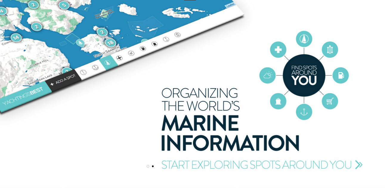
Using a customized Google Map a friend made for me with a few of his favourite boating spots, the CFS and some travel websites for inspiration, I started building a more modern CFS-type resource for marine information, called Yachtingsbest.com.
Initially Yachtingsbest.com was just something my friends and I could use. As it grew, however, I became more passionate about gathering, organizing and disseminating marine information for universal use. A tool like this could make boating more accessible, more fun and potentially safer. It would offer mariners a tool for planning and discovery in a way never before possible. Finally, the tool was so scalable that it would work on any smartphone, tablet or computer, anywhere in the world.
In early 2015, we started exploring if there were any higher cause problems that could benefit from free access to the Yachtingsbest.com platform. Community initiatives, as we call them, are areas that won’t generate revenue, but hopefully help solve an industry problem. The first community initiative, aimed at protecting marine wildlife, was launched with the B.C. Cetacean Sightings Network.
After months of work, our initiative, now called Yachting’s Best, Marine Conservation, is fully built and designed to allow any marine conservation organization to map protected and sensitive areas, document boaters’ best practices, and send communications globally. For our part, conservation-related information is displayed front and centre on Yachtingsbest.com to inspire greater boater awareness and help protect critical habitat. It’s a great mutual relationship that could have a significant effect on protecting critical habitat and marine wildlife.
Our second initiative, still under development, is called Yachting’s Best, Emergency Services. This program will focus on documenting emergency service contact information and, for when external assistance isn’t needed, the locations of medical resources on land. This would include hospitals, medical clinics, AED locations and Coast Guard stations, along with their contact info, how to get there, where to leave your boat, and so on.
The end result of all our efforts is a web application that we hope will become mariners’ first stop when planning an excursion on the water. It works on any smartphone, tablet or computer connected to the internet and offers the quick discovery of marinas, anchorages, supplies and much more. The system also includes custom “discovery maps,” crowd-sourced and professional spot write-ups, built-in weather and Navionics chart data, conservation information, soon to be launched emergency services and more. And the best part? We’re just getting started.
Yachtingsbest.com is available to use now (in Beta) on our website. Also, visit us at the Vancouver Boat Show to learn more about our community initiatives. I’d like to add a special thanks to everyone in the B.C. boating community who has offered their support.