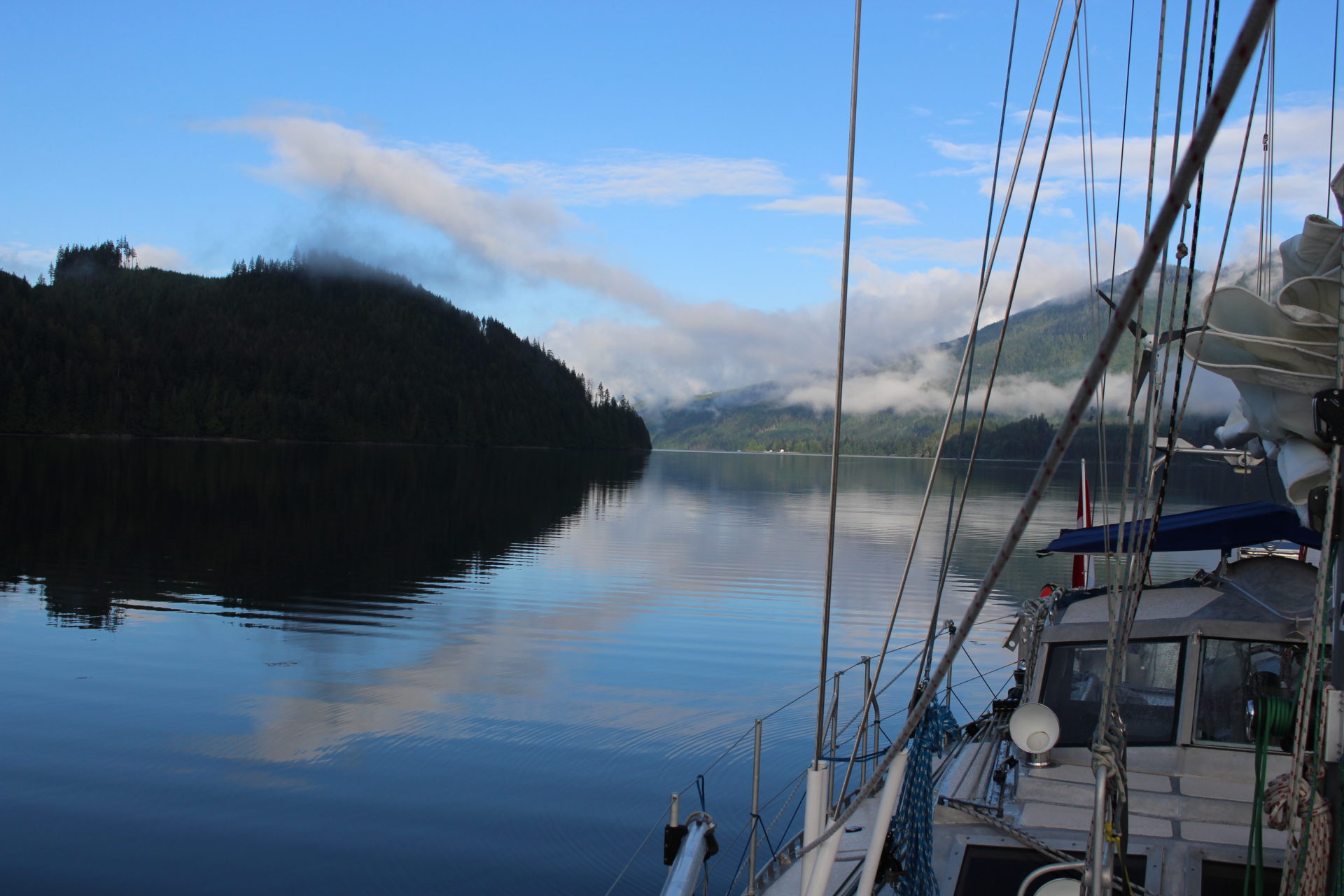

We all seek those euphoric moments while making a passage, where there is a favourable current and the wind is on our beam, or better yet, the wind is on our stern quarter with calm seas. Top this off with a blue sky that is clear as far as the eye can see, and we are in heaven. We have found ourselves in the right place at the right time!
What Makes For A Successful Cruise?
Luck and happenstance or good planning with a little due diligence? Maybe a little bit of each.
Many of us know somebody that hit the jackpot on the first or second pull of the one arm bandit, or that lucky friend that dropped off a resume the same day a company decided they needed a new manager. Many of our endeavors in life have very much to do with what we call luck or happenstance for a positive outcome. Quite often we refer to this as being in the right place at the right time. Is this really luck? Luck is something we don’t normally think of as being controllable, but more often than not we can control where we are, and the time we are there. That means we can affect our “luck” and control the outcome in most situations during a passage.
During a 30-hour Yachtmaster evaluation a few years back, I was required to complete a blind navigation exercise. The navigator, me, had to remain below deck, with all windows blanketed, simulating dense fog. We were required to find a buoy that was a couple of miles away. The helmsperson could only tell me the speed through the water, depth and heading. The only visuals they could indicate had to be within one boat length, a mere 35 feet. To top it off, this was in the Bristol Channel, Wales, with a tidal range of 36 feet (second largest in the world) and a current running upwards of four knots. I took out the paper chart along with tide and current tables, calculated the exact tidal height and current for that moment in time and how much it would change over the next 25 minutes. Yikes, the depth was changing a foot every 10 minutes.
As I worked out the course to steer, distances, time and depth contours, the sweat was pouring down my face, even though it was a damp 18°C outside. I relayed this pertinent information up to the helmsperson, and for the next 20 minutes my heart beat as if it was auditioning as a drum for the movie, Whiplash. Every minute or so, I would wipe my brow and ask the helmsperson the depth and speed, then diligently check my course line on the chart to confirm our location. One last confirmation on the depth at the 22-minute, 34-second mark and I exclaimed, “the buoy is directly abeam on the port side. “Can’t see it,” came the reply. “It has to be there,” I urged, “stop the boat!”
The crew still insisted that they couldn’t see it, in their simulated 35-foot visual range. The examiner called me on deck, and there was the buoy 50 feet away—my idea of perfection. The examiner suggested how lucky I was, to which I grabbed the chart and my two pages of calculations. “Really, luck?” I questioned. He retreated by saying, “point taken.”
Nobody asks us about how many beautiful days we have experienced at sea. The question always relates to quantities of violent storms and rogue waves. Our reply is always the same, “a couple of gales in over 40,000 miles.” Then comes a large reference to how lucky we are. Well, this so-called luck was derived from months of research and planning, trying to figure out where we should be at any particular time to avoid bad weather or better yet take advantage of good weather.
Macro
 Ken Gillstrom photo.
On the macro (global, long-term) scale we spend days and weeks thumbing through Jimmy Cornell’s books including World Cruising Routes and World Voyage Planner. These have 100 years of historic information that is compiled in a neat format. They advise the would-be traveller, where to be and not be at any particular time of the year, and the best route to get there. These documents look at seasonal shifts in global weather patterns and currents. This is how we determine our overall routing strategy for our adventures at sea. Our luck here is that someone accurately compiled all this historic information and made it available to us. Beyond that it was hard planning that lead to our successful passages.
Micro
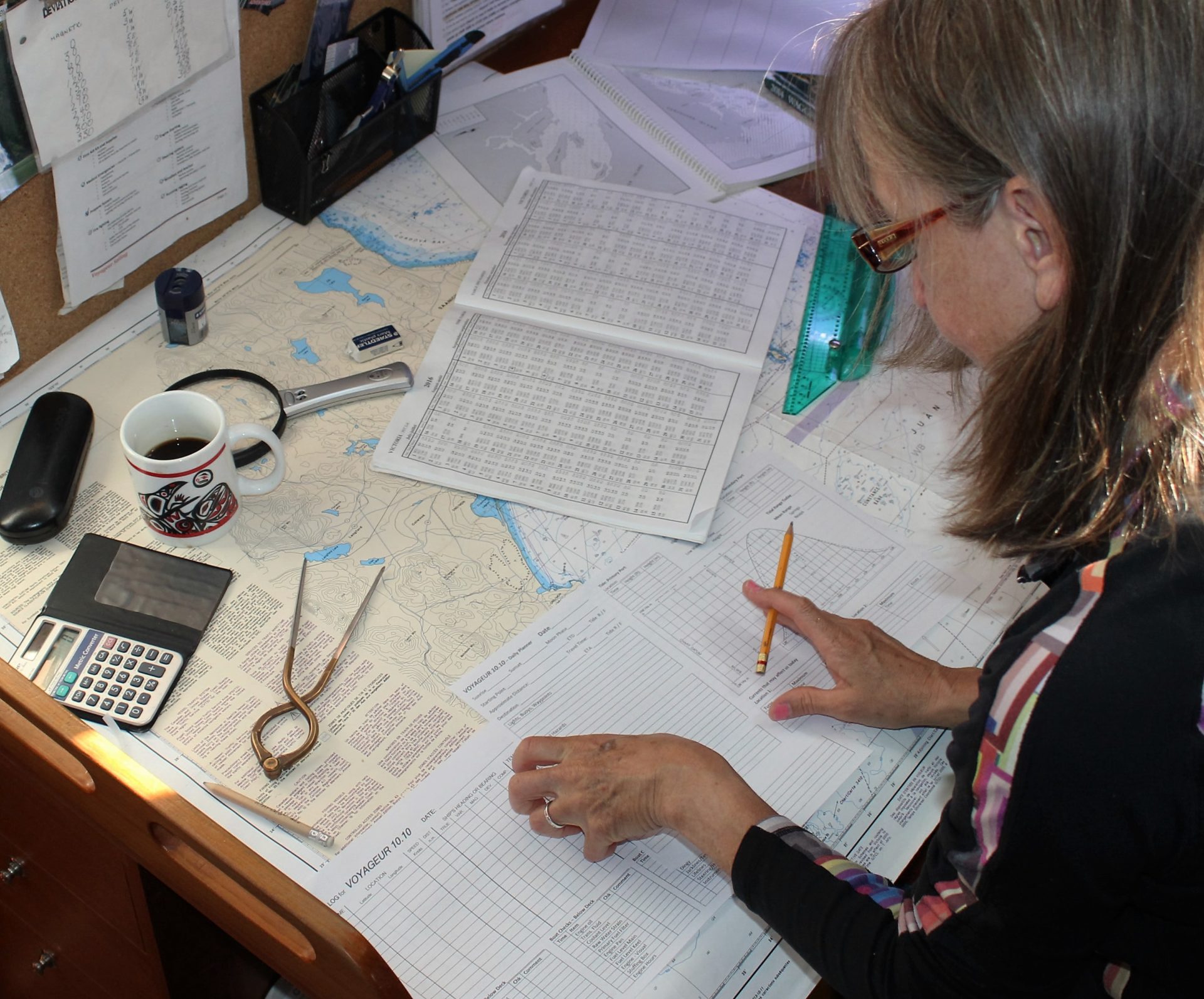
On the micro (local) scale we need to do our due diligence on a daily basis. We will have to transit passes at slack tide, predict depths and wind directions in anchorages, plan arrivals in daylight hours, and calculate currents that may help or hinder our progress. And we need to be aware of other factors too, such as bridge clearances or openings. While cruising, we need to make this planning routine a morning ritual.
Make Your Own Luck
 Ken Gillstrom photo.
Counting on luck and happenstance will eventually lead to disaster, probably sooner than later. We need to properly plan our day, every day, to ensure that we are in the right place at the right time. This takes but a few minutes in the morning and helps to get our brains in gear.
Many times it is prudent to do some preliminary calculations the night before. That first cup may have to be brewed in pre-dawn hours in order to make a slack or favourable tide later in the morning.
The whole purpose of this preplanning is to get as many environmental conditions as you can working in your favour throughout the day. This is making your own luck.
The Wrong Place at the Right Time
Forgetting to plan, getting it wrong, or having delays along the way, can quite often ruin your day or night. However, sometimes a delay can lead to some incredible new adventures. We were 12 hours into a passage from Campbell River to Ladysmith when we calculated that we were running behind schedule.
Our passage planning had indicated that we had a specific window of time to transit Dodd Narrows. Knowing that we would be cutting our arrival time a little too close, we started to look for alternative destinations. Happenstance had us looking to starboard, where we noticed an island. It was about two miles away… Carol took a glance at the chart and recognized its name; Mistaken Island. “That name sounds really familiar,” she remarked. Having just read The Curve of Time, I replied, “Yes, there was a full chapter about some crazy goat keeper there, back in the ’30s.” Carol shook her head saying, “No, I think that’s the island where our friends from Barrie moved to, 16 years ago.” “Seriously?” I replied, “Do you really think that’s the one? Do you have a number for them?”
Carol scrambled below to find her phone. “Here’s the number! I’m dialing now.” Sure enough it was their island! They indicated that the dock might just accommodate a 45-foot sailboat, but the depths in the small bay may be questionable at low tide. The approach to the dock must be at high tide.
A quick glance at our preplanning documents verified, high tide was just an hour away. Ha, perfect timing (or maybe luck?). It was also a neap tide so the tidal range was smaller, allowing us more water under our keel at low tide. The chart indicated the entrance was impassable, however our friend’s hand gestures guided us past the now submerged treacherous reef.
Securely tied to the compact dock, our anxiety level amplified to new heights as I observed boulders just below the surface. We were completely surrounded by them, and the tide was ebbing.
We took soundings with our lead line, every three feet or so, around the perimeter of the boat and checked the expected tidal range. “It looks like we will have 12 inches under the keel and
rudder at low,” I stated. This being too close for any error, Carol meticulously reconfirmed my calculations. We continued to recheck the soundings every couple of hours until the tide started to flood. Then we breathed a sigh of relief. However, we were surrounded by jagged rocks and our bow almost kissed the boulders on shore. Satisfied with our situation we departed Voyageur. Our long lost friends gave us a warm welcome as they noticed the tense looks on our faces.
Stress levels varied over the next couple of days as the rocks appeared and disappeared with the changing tide. We were fortunate that the weather was calm and we didn’t have to be overly concerned with a swell. On the other hand, the tidal range was starting to increase, leaving a smaller margin for error under our keel, so we timed a safe departure from the basin that had engulfed our vessel.
We didn’t make Dodd Narrows on the planned day, nor the next two, as we enjoyed the unplanned diversion. Yes, there are times when our extensive planning goes out the window due to unforeseen circumstances and we need to be prepared to adapt to new situations. We devise a new plan and sometimes, just go with the flow.
Getting it Right
While on the water, either anchored or under way on a passage, we are confronted with an ever-changing dynamic environment. Preparing your plan every morning while having that first cup of whatever, or the previous evening, before happy hour will give you an idea of what is in store for you that day and what you will be able to comfortably accomplish.
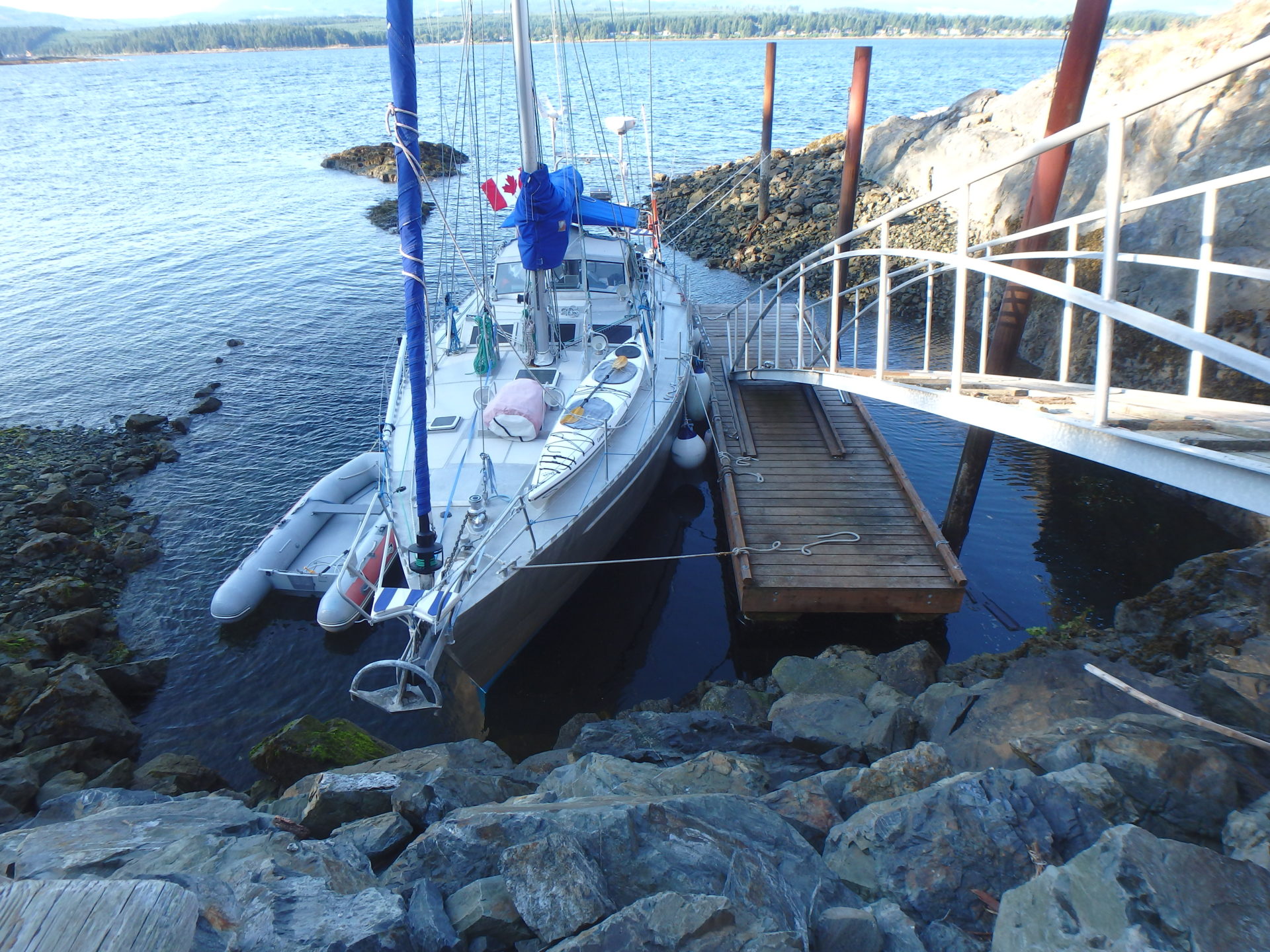 Voyageur 10.10 sits in a tidal pool at Mistaken Island. Entry to this dock was only possible at high tide, then we completed meticulous calculations of tidal heights for a number of days. Combining these calculations with measurements from a lead line ensured that we would not be touching bottom at any point during our week-long visit. Ken Gillstrom photo.
DAILY PRE-PLAN
1. Check Weather Forecasts from Multiple Sources
Quite often you will get conflicting reports. Compare the forecasts to your own observations relating to wind speed and direction, wave height and direction, cloud patterns and barometric pressure trend.
2. Read the Notices to Shipping
Broadcast on VHF along with weather forecasts, these may have pertinent information related to your cruising area, such as hazards, out of position buoys, or lights that may be extinguished.
3. Note the Times for Sunrise and Sunset
This sounds simple, but can be critical when making landfall or determining distance to be covered in daylight hours. You should also note how long you have visible daylight before and after these times.
4. Record the Tidal Heights and Times for the Day
Prepare a tidal curve to determine intermediate depths so you can quickly calculate tidal depths.
5. Check the Current Tables for Related Passes
The timing of your entire day may be determined by slack tide at a particular pass. Make sure you know when you can transit.
6. Be Familiar with the Current Atlas and Current Symbols on Charts
Moving with the direction of the tidal current can greatly increase your speed and reduce the frustration that comes when trying to travel against the current.
7. Peruse the Sailing Directions and Cruising Guides
These will provide you with “local knowledge” about the cruising area, including prevailing winds and current, port, marina and anchorage information, specific hazards and aids to navigation.
8. Complete a Boat Checkout
Yes, a printed checkout sheet so nothing is missed. After doing checks dozens or even hundreds of times, it is easy to become complacent and think you don’t need a list. After doing my checks that way and missing some important items, I always use a list now and make notes of deficiencies. We try to take remedial action immediately.
9. Plot your Sail Plan on a Paper or Electronic Chart
•Note distances to be travelled, relevant hazards and calculate your estimated time of departure and arrival.
•Look for alternate ports that may be utilized if your day doesn’t go as planned!
•Share your sail plan with a friend or relative.