For boaters looking for more adventure than Desolation Sound, some of the best cruising on the BC Coast lies beyond the passes that lead north to Johnstone Strait.
Boaters departing Desolation Sound can take the eastern set of passes that include Yuculta Rapids, Gillard Pass and Dent Rapids (see PY September 2021). This four-mile stretch of strong current takes a bit of planning but the bottom line, if northbound, is to arrive at the Yuculta Rapids just as the current turns to ebb.
There are two other routes leading north, both with excellent anchorages along the way. The “middle” route takes in Surge Narrows and the Upper and Lower Rapids of Okisollo Channel. The “west” route encompasses Discovery Passage and Seymour Narrows—the main channel for commercial traffic.
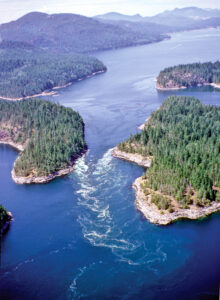
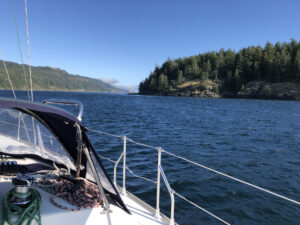
 Cruising up Discovery Passage, approaching Seymour Narrows.
MIDDLE ROUTE—THE “EASY” WAY
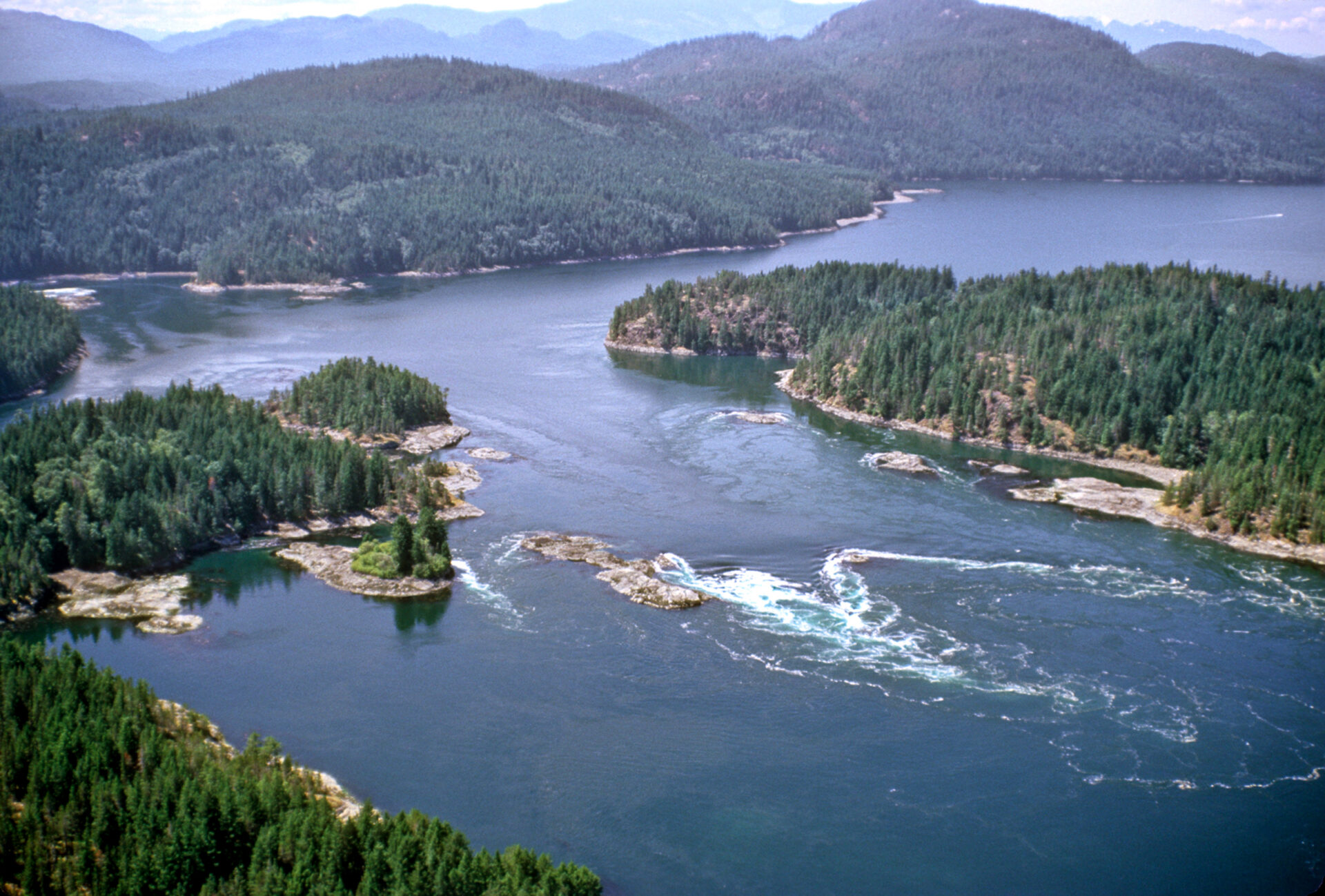
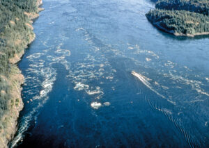
 Surge Narrows can reach 12 knots on a flood.
Surge Narrows and Okisollo Channel are a good option for boaters departing from Rebecca Spit or Desolation Sound. This is a scenic route running between Quadra and Maurelle islands and has the attraction of beautiful Octopus Islands Marine Park, located in the middle of the passes. This route is also good if you plan to continue on to Johnstone Strait, eight miles northwest of the Lower Rapids in Okisollo Channel. These passes are not as fearsome as Seymour Narrows because of weaker currents, less turbulence and fewer commercial vessels. This middle route is probably the easiest of the three northern routes and offers the added bonus of superb scenery and excellent anchorages. The first rapids are Surge Narrows and, six miles north, are the more turbulent Upper and Lower Rapids in Okisollo Channel.
SURGE NARROWS and BEAZLEY PASSAGE
Surge Narrows to Beazley Passage, is the fastest-flowing pass of the middle route and currents here can be turbulent, especially on the south-setting flood that can reach 12 knots. On large tides you must arrive at Beazley Passage very close to slack, within 15 minutes, to ensure a safe transit because this pass turns very quickly on large tides. Fortunately, there are no twists or turns such as those at Gillard Passage and the pass is fairly easy to navigate. Connecting Hoskyn Channel with Okisollo Channel, Surge Narrows actually begins at Welsford Island at the southeast end and extends northwest through Beazley Passage, where the current is strongest, and then to Surge Narrows between Antonio Point and Quadra Island.
Beazley Passage is the only safe channel through the Settlers Group of islands, although it does present certain difficulties on both the flood and the ebb. On the flood there is significant deflection of current off a point southwest of Sturt Island jutting to Peck Island. This generates tremendous turbulence and appears as a shear zone of current crossing the pass. Working the backeddy off Sturt Island and crossing this shear (as we once vainly attempted) is not an option during strong current as it is easy to lose control and, because the pass is narrow, there is little room to recover. If you are going with the southbound flood be sure to give Tusko Rock a wide berth and favour a course closer to Peck Island.
 Transiting Surge Narrows.
The ebb produces less turbulence, but there is a set toward Tusko Rock, which dries at LW and is located just west of Sturt Island. Boaters should favour the west side of the passage until clear of Peck Island.
Entering Surge Narrows from the west side of Peck Island is not recommended because of strong turbulence in this rock-strewn passage. The route north of Sturt Island is not recommended either because of its numerous reefs and strong, turbulent currents that can set you onto danger very quickly.
A provincial marine park encompasses most of the Surge Narrows shoreline and several of the Settlers Group islands, including Peck but not Sturt and Goepel. The park is best visited by dinghy at slack.
 OKISOLLO CHANNEL—UPPER AND LOWER RAPIDS
 OKISOLLO CHANNEL—UPPER AND LOWER RAPIDS
Currents in the Upper Rapids, the first set of rapids encountered when northbound, are considerably stronger (up to 11 knots) than those in the Lower Rapids, which usually run less than six knots. The Upper Rapids passage is also encumbered with reefs and rock outcroppings that generate strong deflection. Seas can be quite turbulent in the area near Bentley Rock during large tides. There can also be whirlpools and strong current at the west entrance of Hole in the Wall but there is plenty of deep water and room to maneuver.
The safest route through this pass is a course favouring the east side of the channel, giving Bentley Rock a wide berth. On the south-flowing flood, the strongest deflection is just south of two small islets (one of which is marked ‘10’ on Chart 3537) on the east side of the channel below Owen Bay. During floods it is safe to cross over to Quadra Island once you are past Diamond Bay. The ebb in the Upper Rapids is even more confused, especially in the area downstream of Bentley Rock. Be careful to avoid the strong set to Bentley Rock by crossing to the E side of the channel well upstream. Currents in Okisollo are strongest around this rock and the forces of water here are very hazardous.
 Okisollo Channel.
Although Okisollo’s Upper Rapids can be turbulent, the pass is wide and there are opportunities to pull out and assess the situation if conditions are uncomfortable. Owen Bay is a good anchorage to wait out strong ebb tides. The Lower Rapids are more benign, with currents rarely exceeding five knots in the channel south of Gypsy Shoal. The channel north of Okis Islands is free of hazards with less current.
Okisollo Channel enters Discovery Passage about four miles south of Chatham Point, which marks the eastern entrance to Johnstone Strait.
DISCOVERY PASSAGE
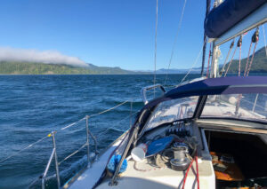
 Although we have transited Discovery Passage many times over the years, there is still something exciting about cruising along this route. Hemmed in by the steep slopes of Vancouver Island and the forested shores of Quadra Island, this wide ribbon of cold, swift-flowing water bustles with commercial traffic all summer long. Even the leviathan liners are very careful about timing their transit for slack water at Seymour Narrows, which is one of the most formidable on our coast with currents reaching 16 knots. As one cruise ship captain told us, “Everything hinges on Seymour Narrows. It tells us how fast to go from Sitka all the way down the Inside Passage. No other pass compares to Seymour Narrows.”
For the northbound boater, this passage really starts a few miles south of Cape Mudge, where the first effects of currents from Discovery Passage are felt a few miles north of Mitlenatch Island. Even during calm conditions, the waters here can be a little choppy and rolling. During strong southerly winds (25 knots or more) against a flood stream, the seas can be dangerous. In the past, numerous vessels have been lost in this area, usually during winter storms. In summer, southeasterlies are not as common, but seas can still be rough and currents strong in the area a few miles south of Wilby Shoals.
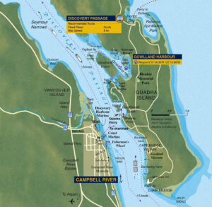
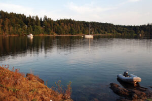 Gowlland Harbour off Quadra Island.
If you are northbound and bucking a flood tide, the best route to avoid current is to pass close to the red buoy at Wilby Shoals (stand off a mile to avoid the set) and follow the 20-metre line to the Cape Mudge lighthouse. This will keep you away from the rough water coming out of Discovery Passage and inside the backeddy that starts south of Cape Mudge. Once past the lighthouse, follow the Quadra Island shoreline until you’re near Whiskey Point, then either cross over to Campbell River or proceed along the Quadra shore to the anchorage of your choice.
Discovery Channel, between Campbell River and Quadra Island, is a busy place so, in addition to the current, be prepared for traffic. There are the hourly crossings of the Quadra Island car ferry, plus the comings and goings of tugs and barges, fishing boats, numerous pleasure craft and cruise ships, which usually transit the pass during evening or night-time slack. On weekends in the summer there can be four or five ships lined up from Cape Mudge to Seymour Narrows. However, Discovery Passage is wide and straight, and you can easily pick a clear spot if you need to cross the channel. Keep your VHF on Channel 16 if you need to clarify a situation with another vessel.
 SEYMOUR NARROWS
 SEYMOUR NARROWS
About two miles in length and less than a half mile in width, this is our favourite pass to get to Johnstone Strait. Back in the 1950s, the currents in Seymour Narrows were measured using drift poles (eight-foot-long two-by-twos with lead at either end and a flag stick) and a transit mounted on a cairn on Maud Island. Canadian Hydrographic Service surveyors would measure the time the pole needed to travel at given angles on the transit to determine current speed. CHS staff eventually used a 25-foot inflatable dinghy with plenty of horsepower to stay in one position in the pass while a probe, three feet below the surface, measured current.
Hydrographers say the strongest currents at the narrows are in the vicinity of Ripple Rock (slightly west of mid-channel, directly beneath the hydro lines strung between Vancouver and Maud islands). On a flood, the strongest turbulence will be along the west wall and the area south of Ripple Rock. On an ebb, the turbulence starts between Maud Island and Ripple Rock.
NORTHBOUND vessels should arrive off the Maud Island light within a half-hour of a strong ebb finishing or beginning (neap currents of less than eight knots give latitude of up to an hour). Once into the narrows, keep on the dark water or “tongue” of the current to avoid the whirlpools and eddies north of Maud Island up to North Bluff. The main thing is to try to stay clear of white water and turbulence. If you have a small sailboat with low power it might be prudent on big tides to be at the Maud Island light at slack or just a few minutes into the north-flowing ebb. If you’re in a top-heavy powerboat, the same advice would apply.
One aspect of Seymour Narrows, and a common characteristic of most passes, is the increase of wind speed in the narrowest part of the pass. This is especially vexing if a strong northwesterly is blowing down Johnstone Strait and the wind tries, like the current, to squeeze between Vancouver and Quadra islands. It’s not uncommon to experience winds of over 30 knots in Seymour Narrows in summer months.
If you’re northbound and the slack is LW, be sure to arrive at the pass before the end of the ebb because slack here on large tides doesn’t last long—five to 10 minutes at most—and you’ll want to be past Brown Bay before the south-flowing flood gets underway, which can be brutal in a slow-moving boat.
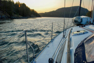
 Once into the narrows, keep in the dark water or “tongue” of the current to avoid the whirlpools and eddies.
SOUTHBOUND boats should be opposite Brown Bay within the hour of a flood ending or beginning. If a large spring flood is underway, it would be wise to be here within a half hour of its end or beginning. On floods, Sailing Directions advises to keep well away from the west shore when transiting the narrows. The worst turbulence is often south of Ripple Rock, especially if wind is against current, and staying away from this hazard should keep you out of harm’s way. Once past Ripple Rock there is plenty of room to manoeuvre away from any north-bound vessels. The good news about Seymour Narrows is that there are no obstructions and just one strong, main stream.
WHEN READING CURRENT tables, boaters often assume that the speed of the ebb or flood is like a sine wave, and that being one hour late for slack means the current should be only a fraction of the maximum flow. However, there are surges and slow periods of flow as water backed up at one end of the pass is suddenly released at slack and rushes through the pass to temporarily equalize with the water level on the other side.
“In some passes—and this is quite pronounced in Seymour Narrows—the flow is non-linear,” former CHS scientist Mike Woodward relates. “So, the flow is not comparable to a sine wave—slowly building to maximum flow—but more like a sawtooth wave. In other words, the current can come on strong very quickly.”
 Woodward has seen many boats trying to buck a big flood at Seymour Narrows— a hazardous practice for this particular pass. “If you try to use the Maud Island backeddy, which is about three knots in a north direction, and your boat has a hull speed of 10 knots, that means you are travelling at 13 knots over ground. When your boat crosses over the flooding jet—which it has to do right near the beacon—it could be hit with 15 knots of current. Suddenly the hull is being forced to go at 28 knots for a brief time and the bow wave can go over the prow or perhaps cause the vessel to roll. As well, you run the risk of overheating your engine, which could happen just as a large tug and barge are coming on you. There is no point in sitting in the pass for a half hour or more, going nowhere, when you could just as easily go around the corner and anchor behind Maud Island and have a cup of tea and save all that fuel.”
FOR NORTHBOUND BOATS the tension eases once you’re past North Bluff, and upon reaching Separation Head the currents lessen considerably. The only hazard that might remain will be the strong north-westerlies that are common in summer months. But boaters now have beautiful destinations lying north of the passes to look forward to, such as Kanish Bay, Handfield Bay and Forward Harbour.