

Most West Coast boaters are familiar with the Dreamspeaker Cruising Guide series. There are seven guides in total, all hand-crafted by Anne and Laurence Yeadon-Jones and produced by Harbour Publishing on the Sunshine Coast.
There are other useful guidebooks but what distinguishes the Dreamspeaker series are Laurence’s beautiful, detailed line and water coloured drawings of the marinas, anchorages and harbours. These drawings are what led me to track down the famed local couple.
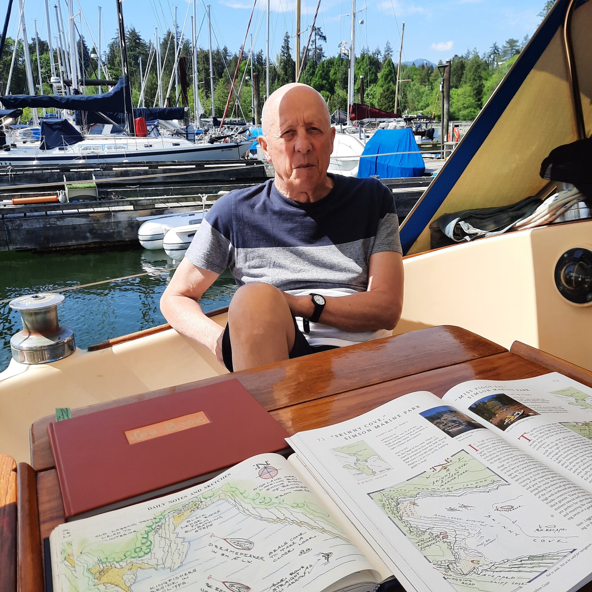
As it happens, Dreamspeaker’s home base is at the Vancouver Rowing Club, just a short walk or row from our home base at Coal Harbour Marina. I put in a call to Laurence Yeadon-Jones who very kindly offered to meet me on their boat and to show me his logbooks.
Anne and Laurence’s story was ably told by Marianne Scott in the October, 2016 issue of Pacific Yachting (read the story at pacificyachting.com/dreamspeaker). They were living and working in London until they decided to go adventuring and sail across the Atlantic Ocean, ultimately ending up in Vancouver. Once established, Anne and Laurence began exploring the West Coast on Dreamspeaker.
The idea for the guidebooks arose one day when the Yeadon-Joneses were anchored in Skinny Cove on South Thormanby Island. R.X. Escape was anchored nearby and they invited the boat’s owner to come aboard Dreamspeaker for happy hour.
While the three of them enjoyed cocktails in the cockpit, Mr. RX looked over one of Laurence’s logbooks. It was a thing of beauty with meticulous entries in precise script, reflecting his training as an architect. On the opposite page was a detailed colour sketch of that night’s anchorage.
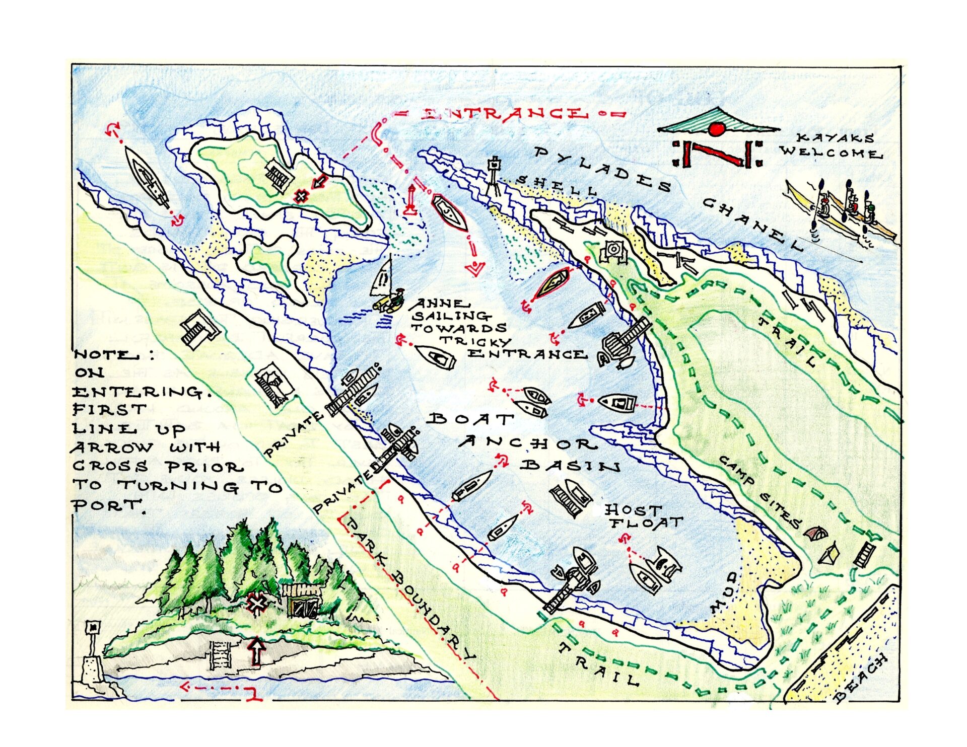 An earlier edition of the Pirates Cove chart.
“You should publish these and share your knowledge with the rest of us.” That chance encounter in Skinny Cove led to the creation of the series of seven Dreamspeaker Cruising Guides for boaters.
The first guide book covering the Gulf Islands was published in 1998 by Raincoast Books. It was followed by Desolation Sound & the Discovery Islands and Vancouver, Howe Sound & the Sunshine Coast.
Raincoast then aquired the Canadian publishing rights to J.K. Rowling’s Harry Potter series and decided not to continue with cruising guides.
In 2005 Harbour Publishing of Madiera Park acquired the rights to publish the Dreamspeaker Cruising Guides. The Yeadon-Joneses continued to research the West Coast, adding to the series with The Broughtons, The West Coast of Vancouver Island, The San Juan Islands and Puget Sound.
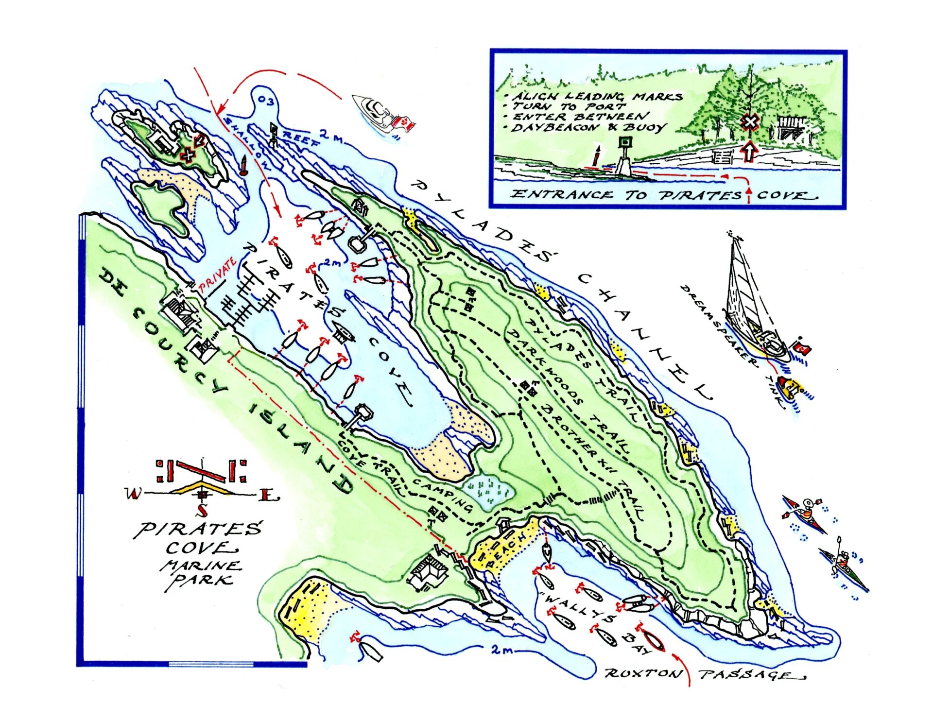 The final draft of Pirates Cove.
Each book starts with an overview of tides and currents, weather forecasts, radio procedures and contact information for the Coast Guard and Border Services, ferry and seaplane services—especially useful for all boaters.
Laurence’s process begins with a detailed drawing of each marina or anchorage, which then has to be reconciled to government-issue charts. The results, although they are not intended for navigation, are pretty darned accurate.
Turning them into colourful drawings suitable for publication is a five-step process:
- All destinations start with Anne and Laurence’s personal research and a sketch. Laurence’s logbook dated 16.06.96 contains a sketch of Pirates Cove and its tricky entrance detail, with positions of the boats at anchor and spots for stern tying.
- The logbook information is reconciled using information taken from the Canadian Hydrographic Service chart.
- The initial shoreline plan showing rocks, reefs, marks, docks, beaches and depth contours is drawn with black line.
- Laurence overlays information from his logbook, showing details of the entrance, rocks, foreshore structures, boats at anchor, park trails and beaches.
- Using pre-mixed watercolours, he washes the drawing like hand-tints from the late 19th century.
The coloured original is scanned, sent to the publisher and incorporated into the guidebook’s design and can be revised as required.
A final line drawing of a small cove can take as little as a day, while a more detailed drawing such as Victoria’s Inner Harbour can take two or more full days. Because he does all the blue watercolour at once, for consistency, Laurence sometimes has as many as 10 destinations going at the same time.
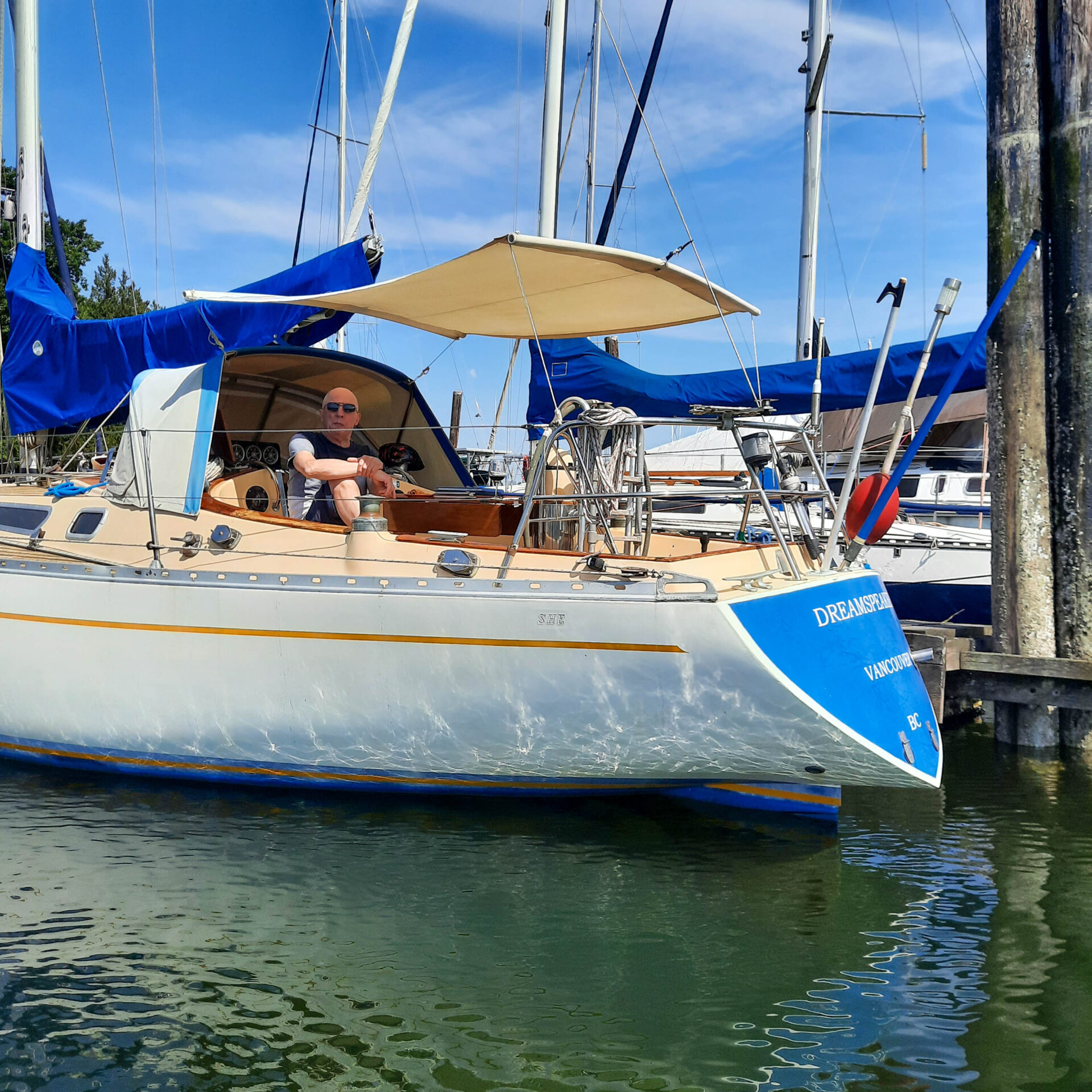
Over the years, Laurence has done more than 1,000 drawings. The seven guidebooks contain approximately 110 drawings each, so he and Anne have invested nearly 30 years of their lives into them. Each guide takes two years to complete from the initial exploration to hand-drawn charts and text to being published.
Each of his drawings is accompanied by a description of the best approach, spots to anchor, depths and the character of the sea floor where known. The drawings themselves highlight hazards to navigation as well as places of interest onshore.
It’s a team effort. Anne is involved in all the research and writes in a personal style to accompany each of Laurence’s drawings. Her descriptions may include directions to the nearest pub or hiking trails along the shoreline, favourite beaches, picnic places and historic sights.
These user-friendly guides are intended to be entertaining as well as informative with boats and kayaks shown coming and going. Dreamspeaker is used as a benchmark in each drawing to show the approach to an anchorage or a marina.
Regular users of the Dreamspeaker guides know that Anne is frequently found exploring anchorages in their yellow dinghy Tink, which is used as a graphic indication of a safe landing spot or dock.
Pauline Bingham met Anne by chance, while shopping on Granville Island. Her husband, John, was also an architect, and all four had lived and worked in London at one time.
The Bingham’s bought a boat and started sailing with Anne and Laurence. Pauline describes the guidebooks as “essential. I can’t remember not using their guides.”
Murray Archdekin is a physician and self-described “detail guy,” recently retired to Gabriola Island. He boats year-round in his 42-foot Monk trawler, and has a collection of Dreamspeaker guides.
As a “visual boater” he liked the diagrams in the guidebooks, but noticed occasional discrepancies. Although the guides are professionally fact-checked, Murray became a friendly proof-reader for the guides. He plans to circumnavigate Vancouver Island and will take Volume 6 along for the ride.

Anne and Laurence have done the rest of us a great service. The Dreamspeaker Cruising Guides cover Puget Sound to the northern tip of Vancouver Island, including the west coast of Vancouver Island.
You can hang one of Laurence’s original drawings of your favourite anchorage in your living room and gaze wistfully at it through the long winter months.
These, plus all seven guides and passage planning charts are available for purchase on their website, dreamspeakerguides.com and the guides are also available at bookstores and marine stores.
